Trail Walking Ville-sous-la-Ferté - Clairvaux 14 km - Photo
 rvapeldo
rvapeldo

User GUIDE

© OpenStreetMap contributors
Length
Length
13.7 km
Max alt
Max alt
317 m
Uphill gradient
Uphill gradient
208 m
Km-Effort
Km-Effort  
16.5 km
Min alt
Min alt
186 m
Downhill gradient
Downhill gradient
208 m
Boucle
Boucle
Yes
Creation date :
2023-04-14 10:37:54.0
Updated on :
2023-04-14 16:00:35.007

(0 Reviews)

Walking
Walking
4h09
Difficulty : Medium

Scan this QR Code to open this trail in the SityTrail application

FREE GPS app for hiking

Logo SityTrail SityTrail

IGN / Geographical institutes

Download SityTrail from the App Store Download SityTrail from Google Play

Logo SityTrail SityTrail World

The world is yours!

Download SityTrail from the App Store Download SityTrail from Google Play Download SityTrail on Huawei AppGallery

About

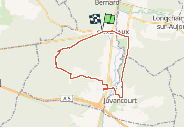
Trail Walking of 13.7 km to be discovered at Grand Est, Aube, Ville-sous-la-Ferté. This trail is proposed by rvapeldo.

Description

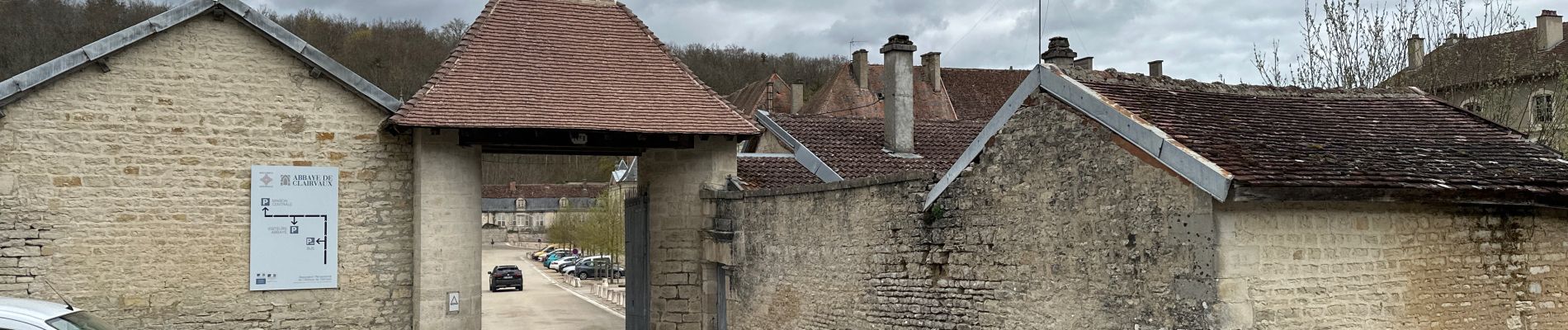
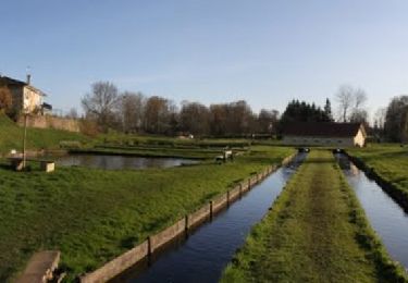
Tour a départ de l’abbaye de Clairvaux, dans les bois environnant, en terminant par la vallée de l’Aube. Elle passe par la fontaine de St Bernard (ponts plutôt branlants, mais il y a plus ou moins moyen de traverser à gué). Charmante église de Ville-sous-la Ferté où l’on retrouve des relique des moines de Clairvaux et bien des explication, plus  son moulin sur l’Aube -qui mériterait une rénovation (il appartient à la prison selon des passants). Retour via la charmant village de Juvancourt avec la maison de l’artiste, Luigi Socci, dédiée à son épouse (il y a des plaques sur la maison).

Elevation profile

Photos

Positioning

Country:
France
Region :
Grand Est
Department/Province :
Aube
Municipality :
Ville-sous-la-Ferté
Location:
Unknown
Start:(UTM)
632853 ; 5334093 (31U) N.

Trails nearby

Trail Mountain bike Ville-sous-la-Ferté - La Via Francigena - Traversée de la Haute Marne - de Clairvaux à Chateauvillain - Photo
Mountain bike
tracegps

Mountain bike

Medium
Ville-sous-la-Ferté, Grand Est, Aube, France
24 km | 31 km-effort
2h 0min
No
Trail Walking Ville-sous-la-Ferté - La Via Francigena - Traversée de la Haute Marne - de Clairvaux à Chateauvillain - Photo
Walking
tracegps

Walking

Medium
(1)
Ville-sous-la-Ferté, Grand Est, Aube, France
24 km | 31 km-effort
5h 0min
No
Trail Mountain bike Juvancourt -  Longchamp Maranville carrière (2) - Photo
Mountain bike
kirikou52

Mountain bike

Juvancourt, Grand Est, Aube, France
21 km | 25 km-effort
2h 44min
Yes
Trail Walking Longchamp-sur-Aujon - château de la sue - Photo
Walking
Xavier Gamba

Walking

Very easy
Longchamp-sur-Aujon, Grand Est, Aube, France
5.5 km | 6.1 km-effort
1h 13min
Yes


Close
My subscriptions