Trail Walking Flavigny-sur-Moselle - Circuit Marche Flavigny - Photo
 geranimo
geranimo

User

© OpenStreetMap contributors
Length
Length
12.4 km
Max alt
Max alt
327 m
Uphill gradient
Uphill gradient
162 m
Km-Effort
Km-Effort  
14.5 km
Min alt
Min alt
222 m
Downhill gradient
Downhill gradient
162 m
Boucle
Boucle
Yes
Creation date :
2014-12-10 00:00:00.0
Updated on :
2014-12-10 00:00:00.0

(0 Reviews)

Walking
Walking
3h11
Difficulty : Medium

Scan this QR Code to open this trail in the SityTrail application

FREE GPS app for hiking

Logo SityTrail SityTrail

IGN / Geographical institutes

Download SityTrail from the App Store Download SityTrail from Google Play

Logo SityTrail SityTrail World

The world is yours!

Download SityTrail from the App Store Download SityTrail from Google Play Download SityTrail on Huawei AppGallery

About

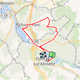
Trail Walking of 12.4 km to be discovered at Grand Est, Meurthe-et-Moselle, Flavigny-sur-Moselle. This trail is proposed by geranimo.

Description

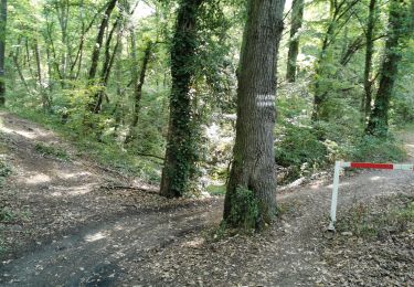
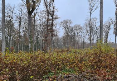
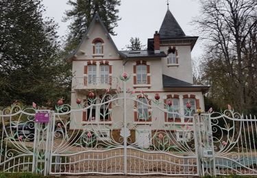
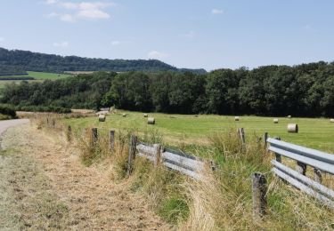
Parking après le pont sur la Moselle,passer le long de l'étang du Breuil, continuer le long de la Moselle, passer sous le pont du Gouvernement, puis sous le pont de l'autoroute, continuer tout droit jusqu'à la passerelle sur le canal, passer sur la passerelle, prendre à droite jusqu'à la route, passer sur le pont, traverser la route et monter jusqu'au centre de Richardménil, traverser la route, passer devant la mairie puis tourner à droite vers le Bois Impérial, passer le pont sur l'autoroute, traverser et prendre en face le petit chemin dans le bois ,il nous mène à un chemin le long d'un lotissement, tourner à gauche et suivre ce chemin jusqu'au château d'eau, prendre à gauche le chemin forestier jusqu'à une intersection, prendre à droite puis à gauche jusqu'à la route, traverser, en face un gros chemin qui redescend jusqu'au canal, à gauche jusqu'l'écluse, à droite sur le pont et tout droit jusqu'au parking.          

Elevation profile

Positioning

Country:
France
Region :
Grand Est
Department/Province :
Meurthe-et-Moselle
Municipality :
Flavigny-sur-Moselle
Location:
Unknown
Start:(UTM)
292818 ; 5383172 (32U) N.

Trails nearby

Trail Mountain bike Tonnoy - Menil-Benney - Photo
Mountain bike
regish54

Mountain bike

Easy
Tonnoy, Grand Est, Meurthe-et-Moselle, France
13.1 km | 16.9 km-effort
1h 11min
No
Trail Walking Flavigny-sur-Moselle - Flavigny sur moselle - Photo
Walking
Jacques-WIRTH

Walking

Very easy
Flavigny-sur-Moselle, Grand Est, Meurthe-et-Moselle, France
10.1 km | 11 km-effort
3h 1min
Yes
Trail Walking Flavigny-sur-Moselle - Flavigny 2  12 100m + 197m  - Photo
Walking
DanielROLLET

Walking

Very easy
Flavigny-sur-Moselle, Grand Est, Meurthe-et-Moselle, France
11.9 km | 14.1 km-effort
3h 13min
Yes
Trail Mountain bike Flavigny-sur-Moselle - FLAVIGNY 2015-10-12 - Photo
Mountain bike
DENOMME

Mountain bike

Medium
(2)
Flavigny-sur-Moselle, Grand Est, Meurthe-et-Moselle, France
28 km | 34 km-effort
2h 37min
No
Trail Mountain bike Flavigny-sur-Moselle - 16km-decouverte - Photo
Mountain bike
regish54

Mountain bike

Easy
Flavigny-sur-Moselle, Grand Est, Meurthe-et-Moselle, France
12.2 km | 16.2 km-effort
1h 17min
No
Trail Walking Flavigny-sur-Moselle - Flavgny - la boucle verte - Photo
Walking
jean-marie.parachini

Walking

Easy
Flavigny-sur-Moselle, Grand Est, Meurthe-et-Moselle, France
9.5 km | 11.5 km-effort
4h 51min
Yes
Trail Walking Flavigny-sur-Moselle - FLAVIGNY SUR MOSELLE - LA BOUCLE VERTE - Photo
Walking
jean-marie.parachini

Walking

Easy
Flavigny-sur-Moselle, Grand Est, Meurthe-et-Moselle, France
9.6 km | 11.6 km-effort
4h 35min
Yes
Trail Walking Flavigny-sur-Moselle - Flavigny 13 010m +205m - Photo
Walking
DanielROLLET

Walking

Difficult
Flavigny-sur-Moselle, Grand Est, Meurthe-et-Moselle, France
13 km | 15.7 km-effort
3h 5min
Yes
Trail Electric bike Tonnoy - Tonnoy-Sion - Photo
Electric bike
regish54

Electric bike

Medium
Tonnoy, Grand Est, Meurthe-et-Moselle, France
69 km | 81 km-effort
2h 59min
Yes


Close
My subscriptions