Trail Walking Roppeviller - Roppeviller (Rocher de Diane et Altschlossfelsen) 7 520m +190m - Photo

Roppeviller (Rocher de Diane et Altschlossfelsen) 7 520m +190m

© OpenStreetMap contributors
Length
Length
7.5 km
Max alt
Max alt
405 m
Uphill gradient
Uphill gradient
190 m
Km-Effort
Km-Effort  
10.1 km
Min alt
Min alt
290 m
Downhill gradient
Downhill gradient
211 m
Boucle
Boucle
No
Creation date :
2022-08-27 09:13:23.814
Updated on :
2022-08-27 18:55:04.093

(0 Reviews)

Walking
Walking
3h27
Difficulty : Very difficult

Scan this QR Code to open this trail in the SityTrail application

FREE GPS app for hiking

Logo SityTrail SityTrail

IGN / Geographical institutes

Download SityTrail from the App Store Download SityTrail from Google Play

Logo SityTrail SityTrail World

The world is yours!

Download SityTrail from the App Store Download SityTrail from Google Play Download SityTrail on Huawei AppGallery

About

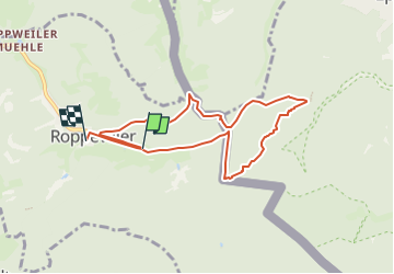
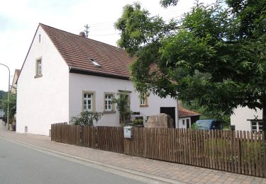
Trail Walking of 7.5 km to be discovered at Grand Est, Moselle, Roppeviller. This trail is proposed by DanielROLLET.

Description

2022 08 27 Rando Saulxures 33 participants avec Henri et Daniel
Temps gris
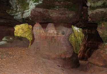
Rocher de Diane pas spectaculaire
Départ parking 10h00, retour église 12h45
Thierry avec 13 participants fait une marche 3
Soit 46 participants dans le bus.
L’après-midi visite citadelle Bitche après un arrêt pique-nique à Hanviller

Elevation profile

Positioning

Country:
France
Region :
Grand Est
Department/Province :
Moselle
Municipality :
Roppeviller
Location:
Unknown
Start:(UTM)
391687 ; 5439669 (32U) N.

Trails nearby

Trail Walking Roppeviller - Le rocher de l'Altschlossfelsen - Photo
Walking
VacheKiri67

Walking

Easy
(2)
Roppeviller, Grand Est, Moselle, France
13 km | 16.1 km-effort
3h 30min
Yes
Trail On foot Roppeviller - Circuit du rocher de l'Altschlossfelsen - Photo
On foot
PRO

On foot

Easy
Roppeviller, Grand Est, Moselle, France
7.1 km | 9.7 km-effort
2h 12min
Yes
Trail On foot Eppenbrunn - Eulenfels-Tour - Photo
On foot
PRO

On foot

Easy
Eppenbrunn, Rhineland-Palatinate, Südwestpfalz, Germany
11.7 km | 15.3 km-effort
3h 28min
No
Trail On foot Schweix - Anneau rouge - Photo
On foot
PRO

On foot

Easy
Schweix, Rhineland-Palatinate, Südwestpfalz, Germany
11.6 km | 14.3 km-effort
3h 15min
Yes
Trail On foot Eppenbrunn - Rundwanderweg Eppenbrunn 4 - Photo
On foot
PRO

On foot

Easy
Eppenbrunn, Rhineland-Palatinate, Südwestpfalz, Germany
7 km | 9.3 km-effort
2h 7min
Yes
Trail On foot Eppenbrunn - Rundwanderweg Eppenbrunn 3 - Photo
On foot
PRO

On foot

Easy
Eppenbrunn, Rhineland-Palatinate, Südwestpfalz, Germany
4.2 km | 5.8 km-effort
1h 18min
No
Trail On foot Eppenbrunn - Grenzweg - Photo
On foot
PRO

On foot

Easy
Eppenbrunn, Rhineland-Palatinate, Südwestpfalz, Germany
11.3 km | 15 km-effort
3h 24min
Yes
Trail On foot Eppenbrunn - Altschloßpfad - Photo
On foot
PRO

On foot

Easy
Eppenbrunn, Rhineland-Palatinate, Südwestpfalz, Germany
10 km | 13.4 km-effort
3h 3min
Yes
Trail On foot Eppenbrunn - Red dot - Photo
On foot
PRO

On foot

Easy
Eppenbrunn, Rhineland-Palatinate, Südwestpfalz, Germany
9.6 km | 12.9 km-effort
2h 55min
No


Close
My subscriptions