Trail Road bike Sémeries - semeries val joly par chapelle sainte hiltrude - Photo

semeries val joly par chapelle sainte hiltrude

© OpenStreetMap contributors
Length
Length
38 km
Max alt
Max alt
256 m
Uphill gradient
Uphill gradient
488 m
Km-Effort
Km-Effort  
45 km
Min alt
Min alt
152 m
Downhill gradient
Downhill gradient
488 m
Boucle
Boucle
Yes
Creation date :
2022-08-23 17:45:58.589
Updated on :
2022-08-23 17:49:20.85

(0 Reviews)

Road bike
Road bike
2h43
Difficulty : Very difficult
Bicycle tourism
Bicycle tourism
0m
Difficulty : Very easy

Scan this QR Code to open this trail in the SityTrail application

FREE GPS app for hiking

Logo SityTrail SityTrail

IGN / Geographical institutes

Download SityTrail from the App Store Download SityTrail from Google Play

Logo SityTrail SityTrail World

The world is yours!

Download SityTrail from the App Store Download SityTrail from Google Play Download SityTrail on Huawei AppGallery

About

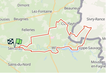
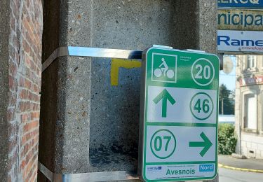
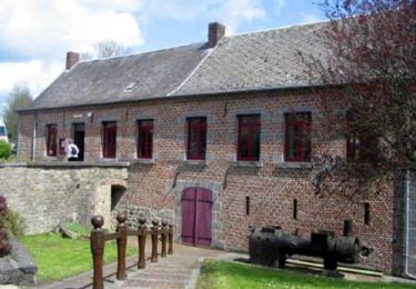
Trail Road bike of 38 km to be discovered at Hauts-de-France, Nord, Sémeries. This trail is proposed by Dominique Garin.

Description

chemin de campagne , bord du lac partie de foret

Elevation profile

Positioning

Country:
France
Region :
Hauts-de-France
Department/Province :
Nord
Municipality :
Sémeries
Location:
Unknown
Start:(UTM)
571535 ; 5552462 (31U) N.

Trails nearby

Trail Walking Felleries - felleries 17,5 km - Photo
Walking
GUIDE
rvapeldo

Walking

Easy
Felleries, Hauts-de-France, Nord, France
17.7 km | 19.9 km-effort
4h 43min
Yes
Trail Walking Avesnes-sur-Helpe - Balisage Camp de César 2° passage 2019 - Photo
Walking
dautriche

Walking

Easy
Avesnes-sur-Helpe, Hauts-de-France, Nord, France
12 km | 13.7 km-effort
3h 33min
Yes
Trail Walking Felleries - Sentier des moulins à eau  -  Felleries - Photo
Walking
tracegps

Walking

Difficult
Felleries, Hauts-de-France, Nord, France
17 km | 19.2 km-effort
4h 15min
Yes
Trail Walking Avesnes-sur-Helpe - Circuit du camp César - Avesnes sur Helpe - Photo
Walking
tracegps

Walking

Medium
(1)
Avesnes-sur-Helpe, Hauts-de-France, Nord, France
11.6 km | 13.2 km-effort
2h 55min
Yes
Trail Walking Avesnes-sur-Helpe - Camp de Cesar balisage automne 2022 - Photo
Walking
Morelli

Walking

Medium
(1)
Avesnes-sur-Helpe, Hauts-de-France, Nord, France
12.4 km | 14.1 km-effort
4h 16min
Yes
Trail Walking Sains-du-Nord - Circuit des Haies et ruisseaux - Sains du Nord - Photo
Walking
tracegps

Walking

Difficult
Sains-du-Nord, Hauts-de-France, Nord, France
13 km | 14.9 km-effort
3h 15min
Yes
Trail Walking Avesnelles - Circuit d'Avesnelles - Photo
Walking
tracegps

Walking

Difficult
(1)
Avesnelles, Hauts-de-France, Nord, France
13.9 km | 15.5 km-effort
3h 30min
Yes
Trail Cycle Felleries - Moulin des vallées de l'Helpe Majeure et de la Solre (32km) - Photo
Cycle
tracegps

Cycle

Medium
Felleries, Hauts-de-France, Nord, France
32 km | 37 km-effort
2h 0min
Yes
Trail Cycle Felleries - Moulin des vallées de l'Helpe Majeure et de la Solre (40km) - Photo
Cycle
tracegps

Cycle

Difficult
Felleries, Hauts-de-France, Nord, France
39 km | 45 km-effort
3h 0min
Yes


Close
My subscriptions