


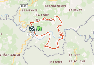

14.9 km | 20 km-effort


User


FREE GPS app for hiking
 SityTrail
IGN / Geographical institutes
SityTrail World
The world is yours!
Trail Walking of 7.8 km to be discovered at Auvergne-Rhône-Alpes, Haute-Loire, Sainte-Sigolène. This trail is proposed by famillerudent.
cette boucle est une variante d'un pr proposé par la haute loire
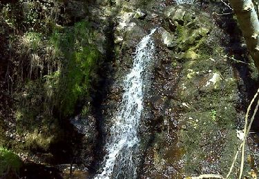
super coin de picnic ou de baignade au km 7 au niveau du gué ou de la pile de pont
possibilité de la raccourcir au km4 avec retour jusqu'au pont (pour la raccourcir de 3,5 km)


Mountain bike

Walking

Walking
Walking
Walking
Walking
Walking
Walking
Walking