Trail Cycle Avesnes-sur-Helpe - avesnes chimay avesnes - Photo

avesnes chimay avesnes

© OpenStreetMap contributors
Length
Length
84 km
Max alt
Max alt
297 m
Uphill gradient
Uphill gradient
977 m
Km-Effort
Km-Effort  
97 km
Min alt
Min alt
149 m
Downhill gradient
Downhill gradient
975 m
Boucle
Boucle
Yes
Creation date :
2022-06-18 15:32:06.191
Updated on :
2022-06-18 15:40:07.184

(0 Reviews)

Cycle
Cycle
0m
Difficulty : Medium

Scan this QR Code to open this trail in the SityTrail application

FREE GPS app for hiking

Logo SityTrail SityTrail

IGN / Geographical institutes

Download SityTrail from the App Store Download SityTrail from Google Play

Logo SityTrail SityTrail World

The world is yours!

Download SityTrail from the App Store Download SityTrail from Google Play Download SityTrail on Huawei AppGallery

About

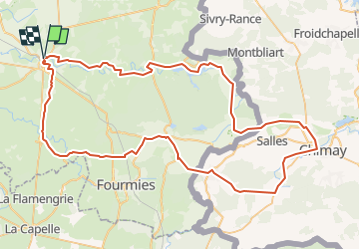
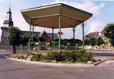
Trail Cycle of 84 km to be discovered at Hauts-de-France, Nord, Avesnes-sur-Helpe. This trail is proposed by Dominique Garin.

Description

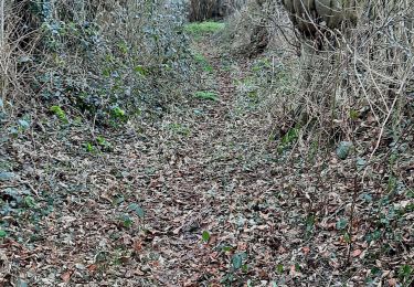
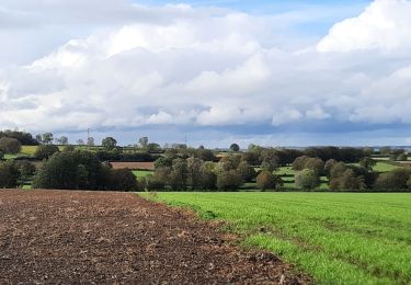
balade dans le bocage ,en bordure de helpe , puis vers le val joly ,puis vers la belgique avec quelques denivelés interesssants ,déguster une bonne bière a Chimay ou une frite puis retour vers la voie verte de chimay momignies pour finir un retour vers le bocage

Elevation profile

Positioning

Country:
France
Region :
Hauts-de-France
Department/Province :
Nord
Municipality :
Avesnes-sur-Helpe
Location:
Unknown
Start:(UTM)
566751 ; 5553475 (31U) N.

Trails nearby

Trail Cycle Saint-Hilaire-sur-Helpe - Moulins et Kiosques autour de Maroilles - Photo
Cycle
Baltykatt

Cycle

Medium
(1)
Saint-Hilaire-sur-Helpe, Hauts-de-France, Nord, France
55 km | 61 km-effort
3h 36min
Yes
Trail Mountain bike Saint-Hilaire-sur-Helpe - Saint Hilaire-Val Joly - Photo
Mountain bike
Baltykatt

Mountain bike

Difficult
(1)
Saint-Hilaire-sur-Helpe, Hauts-de-France, Nord, France
66 km | 74 km-effort
5h 4min
Yes
Trail Walking Avesnes-sur-Helpe - Balisage Camp de César 2° passage 2019 - Photo
Walking
dautriche

Walking

Easy
Avesnes-sur-Helpe, Hauts-de-France, Nord, France
12 km | 13.7 km-effort
3h 33min
Yes
Trail Walking Avesnes-sur-Helpe - Circuit du camp César - Avesnes sur Helpe - Photo
Walking
tracegps

Walking

Medium
(1)
Avesnes-sur-Helpe, Hauts-de-France, Nord, France
11.6 km | 13.2 km-effort
2h 55min
Yes
Trail Walking Avesnes-sur-Helpe - Camp de Cesar balisage automne 2022 - Photo
Walking
Morelli

Walking

Medium
(1)
Avesnes-sur-Helpe, Hauts-de-France, Nord, France
12.4 km | 14.1 km-effort
4h 16min
Yes
Trail Walking Avesnelles - Circuit d'Avesnelles - Photo
Walking
tracegps

Walking

Difficult
(1)
Avesnelles, Hauts-de-France, Nord, France
13.9 km | 15.5 km-effort
3h 30min
Yes
Trail Walking Saint-Aubin - Saint Aubin - Photo
Walking
mjh

Walking

Medium
Saint-Aubin, Hauts-de-France, Nord, France
14.3 km | 16.4 km-effort
2h 54min
Yes
Trail Walking Sains-du-Nord - Sains du Nord - Photo
Walking
mjh

Walking

Easy
Sains-du-Nord, Hauts-de-France, Nord, France
11.3 km | 12.8 km-effort
2h 43min
Yes
Trail On foot Avesnelles - Avesnelles - Felleries - Photo
On foot
FreddyTuerlinckx

On foot

Easy
Avesnelles, Hauts-de-France, Nord, France
10.7 km | 12.3 km-effort
2h 47min
No


Close
My subscriptions