Trail Walking Bambiderstroff - Circuit de la Vallée du Bambesch - Bambiderstroff - Photo

Circuit de la Vallée du Bambesch - Bambiderstroff

 tracegps
tracegps

User

© OpenStreetMap contributors
Length
Length
16.5 km
Max alt
Max alt
406 m
Uphill gradient
Uphill gradient
288 m
Km-Effort
Km-Effort  
20 km
Min alt
Min alt
275 m
Downhill gradient
Downhill gradient
288 m
Boucle
Boucle
Yes
Creation date :
2014-12-10 00:00:00.0
Updated on :
2014-12-10 00:00:00.0

(1 Reviews)

Walking
Walking
4h00
Difficulty : Medium

Scan this QR Code to open this trail in the SityTrail application

FREE GPS app for hiking

Logo SityTrail SityTrail

IGN / Geographical institutes

Download SityTrail from the App Store Download SityTrail from Google Play

Logo SityTrail SityTrail World

The world is yours!

Download SityTrail from the App Store Download SityTrail from Google Play Download SityTrail on Huawei AppGallery

About

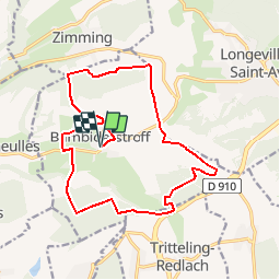
Trail Walking of 16.5 km to be discovered at Grand Est, Moselle, Bambiderstroff. This trail is proposed by tracegps.

Description

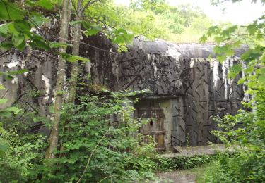
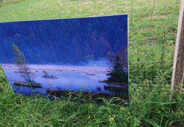
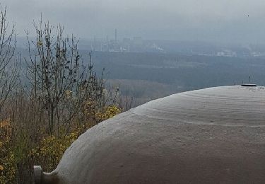
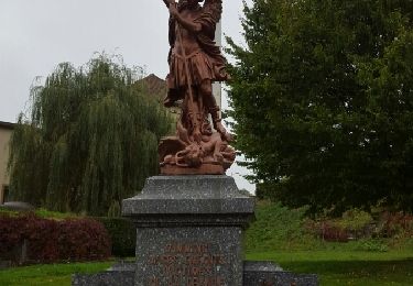
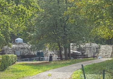
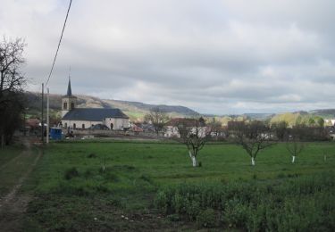
Cet itinéraire vallonné offre au randonneur une variété de paysages et de découvertes insolites au cœur de la nature: ouvrages militaires dont l'ouvrage visitable du Bambesch, éoliennes géantes, croix de chemins sculptées, points de vues panoramiques, forêts sont les ingrédients de ce circuit remarquable. Téléchargez la fiche du circuit.

Elevation profile

Photos

Positioning

Country:
France
Region :
Grand Est
Department/Province :
Moselle
Municipality :
Bambiderstroff
Location:
Unknown
Start:(UTM)
324348 ; 5441516 (32U) N.

Comments

Please log in to post a review or rate the element


Trails nearby

Trail On foot Bambiderstroff - Circuit Vallée du Bambesh - Photo
On foot
PRO

On foot

Easy
Bambiderstroff, Grand Est, Moselle, France
14.6 km | 17.9 km-effort
4h 3min
Yes
Trail On foot Pontpierre - Circuit du golf - Photo
On foot
PRO

On foot

Easy
Pontpierre, Grand Est, Moselle, France
16 km | 19.4 km-effort
4h 24min
Yes
Trail Walking Pontpierre - expo nature Faulquemont  - Photo
Walking
Bob5757

Walking

Very easy
Pontpierre, Grand Est, Moselle, France
3.6 km | 4.3 km-effort
2h 46min
No
Trail Walking Longeville-lès-Saint-Avold - Longeville - Bambiderstroff - Photo
Walking
oger_eric

Walking

Easy
(1)
Longeville-lès-Saint-Avold, Grand Est, Moselle, France
10.4 km | 13.7 km-effort
2h 56min
Yes
Trail Walking Longeville-lès-Saint-Avold - Eric Longeville - Mutschenberg - Photo
Walking
oger_eric

Walking

Easy
(1)
Longeville-lès-Saint-Avold, Grand Est, Moselle, France
8.8 km | 11.7 km-effort
2h 47min
Yes
Trail Walking Narbéfontaine - Eric Narbefontaine - Photo
Walking
oger_eric

Walking

Easy
Narbéfontaine, Grand Est, Moselle, France
15.2 km | 18.9 km-effort
2h 34min
Yes
Trail Nordic walking Bambiderstroff - Eric Bambiderstroff  - Photo
Nordic walking
oger_eric

Nordic walking

Easy
Bambiderstroff, Grand Est, Moselle, France
14.8 km | 18.4 km-effort
2h 35min
Yes
Trail Walking Bambiderstroff - Tour de Bambiderstroff - Photo
Walking
piem

Walking

Medium
Bambiderstroff, Grand Est, Moselle, France
12.8 km | 15.8 km-effort
3h 50min
Yes
Trail On foot Saint-Avold - Circuit Forêt du Warndt - Photo
On foot
PRO

On foot

Easy
Saint-Avold, Grand Est, Moselle, France
14.7 km | 18.6 km-effort
4h 14min
Yes


Close
My subscriptions