Trail Walking Flirey - FLIREY - LES VIGNOTTES - Photo

FLIREY - LES VIGNOTTES

© OpenStreetMap contributors
Length
Length
11.5 km
Max alt
Max alt
314 m
Uphill gradient
Uphill gradient
141 m
Km-Effort
Km-Effort  
13.3 km
Min alt
Min alt
246 m
Downhill gradient
Downhill gradient
141 m
Boucle
Boucle
Yes
Creation date :
2022-03-08 12:33:08.221
Updated on :
2022-03-08 17:31:44.856

(0 Reviews)

Walking
Walking
4h40
Difficulty : Easy

Scan this QR Code to open this trail in the SityTrail application

FREE GPS app for hiking

Logo SityTrail SityTrail

IGN / Geographical institutes

Download SityTrail from the App Store Download SityTrail from Google Play

Logo SityTrail SityTrail World

The world is yours!

Download SityTrail from the App Store Download SityTrail from Google Play Download SityTrail on Huawei AppGallery

About

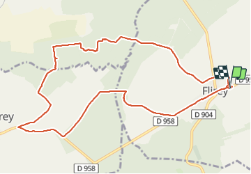
Trail Walking of 11.5 km to be discovered at Grand Est, Meurthe-et-Moselle, Flirey. This trail is proposed by jean-marie.parachini.

Description

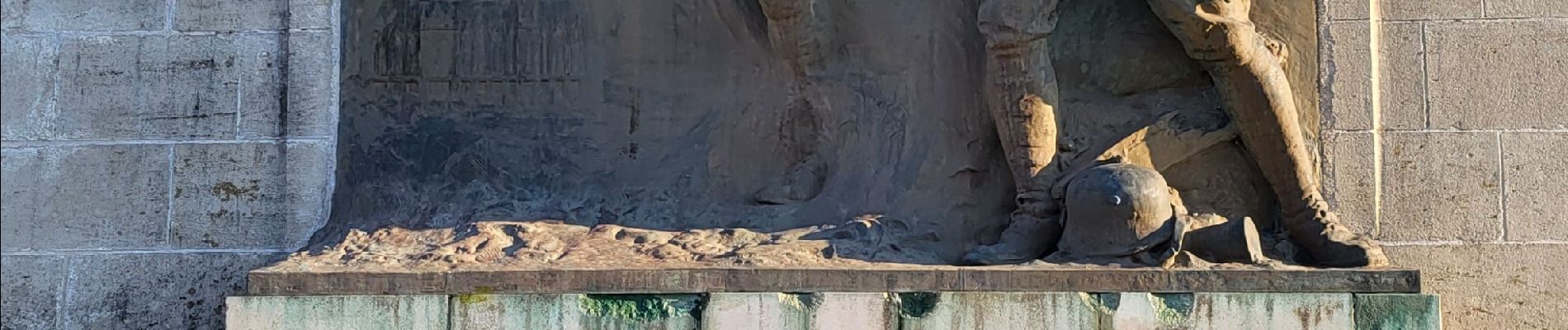
Parcours au départ des ruines de l'ancienne église de Flirey détruite pendant la 1ère guerre mondiale puis passage par les tranchées allemandes de Saint Baussant.
Retour par les abords de Seicheprey et retour au point de départ.

Elevation profile

Photos

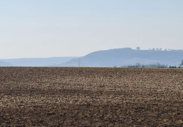
21 photos in total. Please click on a photo to see them all in the gallery.

Positioning

Country:
France
Region :
Grand Est
Department/Province :
Meurthe-et-Moselle
Municipality :
Flirey
Location:
Unknown
Start:(UTM)
709022 ; 5417564 (31U) N.

Trails nearby

Trail Cycle Mandres-aux-Quatre-Tours - La forêt de la Reine et ses mystères - Circuit n° 8 - Photo
Cycle
tracegps

Cycle

Difficult
Mandres-aux-Quatre-Tours, Grand Est, Meurthe-et-Moselle, France
50 km | 56 km-effort
3h 30min
Yes
Trail Walking Flirey - Flirey circuit des Vignottes - Photo
Walking
jean-marie.parachini

Walking

Medium
Flirey, Grand Est, Meurthe-et-Moselle, France
11.5 km | 13.4 km-effort
4h 43min
Yes
Trail Electric bike Lironville - lironville madine - Photo
Electric bike
nouga

Electric bike

Very easy
Lironville, Grand Est, Meurthe-et-Moselle, France
55 km | 64 km-effort
3h 12min
No
Trail Walking Manonville - 8/8/32 Manon Ille petite Suisse lorrainepluie - Photo
Walking
jerome-dupont@laposte.net

Walking

Medium
Manonville, Grand Est, Meurthe-et-Moselle, France
10.5 km | 12.8 km-effort
3h 21min
Yes
Trail Mountain bike Lironville - Lironville domevre  - Photo
Mountain bike
kikkko

Mountain bike

Easy
Lironville, Grand Est, Meurthe-et-Moselle, France
25 km | 30 km-effort
2h 19min
Yes
Trail Walking Flirey - mort marre - Photo
Walking
randolea

Walking

Very easy
Flirey, Grand Est, Meurthe-et-Moselle, France
6.6 km | 7.9 km-effort
1h 34min
No
Trail Mountain bike Mandres-aux-Quatre-Tours - forêt de la reine - Photo
Mountain bike
kikkko

Mountain bike

Very easy
Mandres-aux-Quatre-Tours, Grand Est, Meurthe-et-Moselle, France
30 km | 33 km-effort
2h 51min
Yes
Trail Mountain bike Seicheprey - Secheprey - les paroches - Photo
Mountain bike
fernand1254

Mountain bike

Difficult
Seicheprey, Grand Est, Meurthe-et-Moselle, France
32 km | 38 km-effort
2h 38min
No
Trail Mountain bike Limey-Remenauville - mussi5 - Photo
Mountain bike
nouga

Mountain bike

Medium
Limey-Remenauville, Grand Est, Meurthe-et-Moselle, France
21 km | 26 km-effort
2h 3min
No


Close
My subscriptions