Trail Walking Pont-sur-Sambre - La Sambre à POnt sur Sambre - Photo

La Sambre à POnt sur Sambre

© OpenStreetMap contributors
Length
Length
12.7 km
Max alt
Max alt
175 m
Uphill gradient
Uphill gradient
106 m
Km-Effort
Km-Effort  
14.1 km
Min alt
Min alt
124 m
Downhill gradient
Downhill gradient
107 m
Boucle
Boucle
Yes
Creation date :
2021-04-18 08:15:22.528
Updated on :
2021-04-18 08:16:01.56

(1 Reviews)

Walking
Walking
3h12
Difficulty : Difficult

Scan this QR Code to open this trail in the SityTrail application

FREE GPS app for hiking

Logo SityTrail SityTrail

IGN / Geographical institutes

Download SityTrail from the App Store Download SityTrail from Google Play

Logo SityTrail SityTrail World

The world is yours!

Download SityTrail from the App Store Download SityTrail from Google Play Download SityTrail on Huawei AppGallery

About

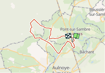
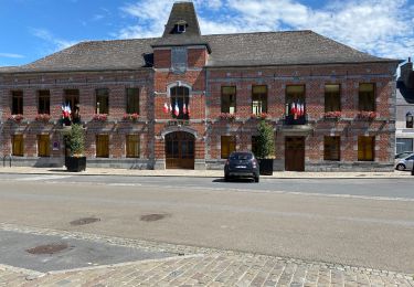
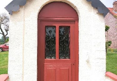
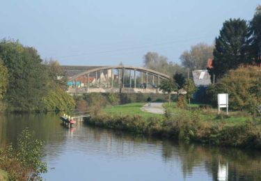
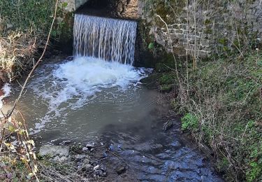
Trail Walking of 12.7 km to be discovered at Hauts-de-France, Nord, Pont-sur-Sambre. This trail is proposed by BrassensJC.

Elevation profile

Positioning

Country:
France
Region :
Hauts-de-France
Department/Province :
Nord
Municipality :
Pont-sur-Sambre
Location:
Unknown
Start:(UTM)
560385 ; 5563578 (31U) N.

Comments

Please log in to post a review or rate the element


Trails nearby

Trail Walking Berlaimont - Circuit du Sart Bara (9km) - Berlaimont - Photo
Walking
tracegps

Walking

Medium
(1)
Berlaimont, Hauts-de-France, Nord, France
9 km | 9.8 km-effort
2h 15min
Yes
Trail Walking Berlaimont - Berlaimont 16 km - Photo
Walking
GUIDE
rvapeldo

Walking

Very easy
Berlaimont, Hauts-de-France, Nord, France
16.1 km | 17.7 km-effort
4h 14min
Yes
Trail Walking Locquignol - CAF forêt de Mormal  - Photo
Walking
reneperrin

Walking

Medium
Locquignol, Hauts-de-France, Nord, France
24 km | 27 km-effort
6h 54min
Yes
Trail Walking Berlaimont - Circuit du Sart Bara (13km) - Berlaimont - Photo
Walking
tracegps

Walking

Difficult
Berlaimont, Hauts-de-France, Nord, France
13.4 km | 14.7 km-effort
3h 25min
Yes
Trail Walking Écuélin - Écuelin  - Photo
Walking
mjh

Walking

Medium
Écuélin, Hauts-de-France, Nord, France
10.6 km | 12.3 km-effort
2h 0min
Yes
Trail Walking Locquignol - mormal coucou 23 km  - Photo
Walking
GUIDE
rvapeldo

Walking

Easy
Locquignol, Hauts-de-France, Nord, France
24 km | 27 km-effort
5h 56min
Yes
Trail Walking Berlaimont - berlaimont 15 km - Photo
Walking
GUIDE
rvapeldo

Walking

Very easy
Berlaimont, Hauts-de-France, Nord, France
16 km | 17.6 km-effort
4h 54min
Yes
Trail Walking Locquignol - Circuit de La Baille d'Obies - Photo
Walking
corsinou

Walking

Easy
Locquignol, Hauts-de-France, Nord, France
8.8 km | 10 km-effort
2h 12min
Yes
Trail Walking Locquignol - coucou - Photo
Walking
jdaviere

Walking

Medium
Locquignol, Hauts-de-France, Nord, France
9.8 km | 11 km-effort
2h 8min
Yes


Close
My subscriptions