Trail Walking Montréal - fources  - Photo
 DuMarsan
DuMarsan

User

© OpenStreetMap contributors
Length
Length
21 km
Max alt
Max alt
176 m
Uphill gradient
Uphill gradient
361 m
Km-Effort
Km-Effort  
25 km
Min alt
Min alt
73 m
Downhill gradient
Downhill gradient
361 m
Boucle
Boucle
Yes
Creation date :
2014-12-10 00:00:00.0
Updated on :
2014-12-10 00:00:00.0

(1 Reviews)

Walking
Walking
5h28
Difficulty : Easy

Scan this QR Code to open this trail in the SityTrail application

FREE GPS app for hiking

Logo SityTrail SityTrail

IGN / Geographical institutes

Download SityTrail from the App Store Download SityTrail from Google Play

Logo SityTrail SityTrail World

The world is yours!

Download SityTrail from the App Store Download SityTrail from Google Play Download SityTrail on Huawei AppGallery

About

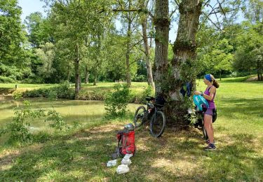
Trail Walking of 21 km to be discovered at Occitania, Gers, Montréal. This trail is proposed by DuMarsan.

Description

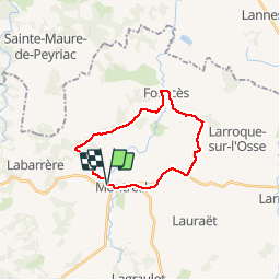
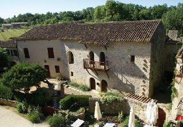
Boucle Montréal du Gers/Fourcés
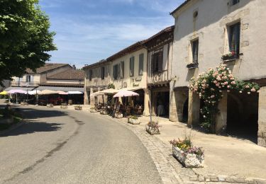
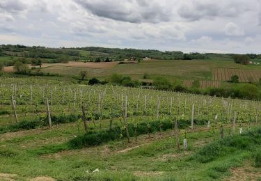
Empruntant les chemins de St Jacques de Compostelle, ce parcours  très agréable dans la campagne gersoise offre la découverte de Montréal et surtout de Fourcés :superbe bastide ronde, parfaitement conservée( une des plus belle de France ? ).
Retour paisible vers Montréal.
Circuit légèrement vallonné ( 350 m de dénivelé )
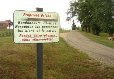
Attention plusieurs circuits s' entremêlent et celui ci ( issu du topo-guide du "pays d' armagnac à pied" ) n' est pas balisé en tant que tel sur le terrain.
Cependant, avec un peu d' attention, il n' y a aucun risque de se perdre.
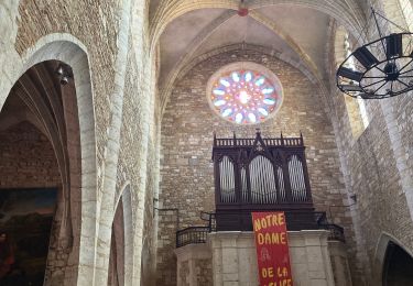
Resto sympathique sur la place ronde, à prix doux : l' auberge de Fourcés.

Elevation profile

Positioning

Country:
France
Region :
Occitania
Department/Province :
Gers
Municipality :
Montréal
Location:
Unknown
Start:(UTM)
274724 ; 4870222 (31T) N.

Comments

Please log in to post a review or rate the element


Trails nearby

Trail Walking Montréal - CC_Velay_EF_22_Montreal_Manciet_20080822 - Photo
Walking
patrickdanilo

Walking

Easy
Montréal, Occitania, Gers, France
28 km | 33 km-effort
6h 30min
No
Trail Electric bike Montréal - 04-06-19 - Photo
Electric bike
lviallet

Electric bike

Montréal, Occitania, Gers, France
44 km | 0 m-effort
2h 56min
Yes
Trail Walking Montréal - chemin de la Tenareze à Montréal du gers - Photo
Walking
Forsans

Walking

Very easy
Montréal, Occitania, Gers, France
10.8 km | 13.1 km-effort
3h 4min
Yes
Trail Cycle Montréal - Montréal - Fourcès - Larressingle - Photo
Cycle
lviallet

Cycle

Easy
Montréal, Occitania, Gers, France
42 km | 49 km-effort
2h 47min
Yes
Trail Mountain bike Montréal - Montréal du gers, eauze,aire sur adour, - Photo
Mountain bike
lablaquiere

Mountain bike

Medium
Montréal, Occitania, Gers, France
68 km | 80 km-effort
9h 21min
No
Trail Walking Montréal - GR 65  Montréal > Eauze  - Photo
Walking
choubaka77

Walking

Easy
Montréal, Occitania, Gers, France
18 km | 21 km-effort
4h 38min
No
Trail Walking Montréal - Montréal du Gers, sur les traces des romains  - Photo
Walking
Santblasi

Walking

Easy
Montréal, Occitania, Gers, France
11.5 km | 13.9 km-effort
3h 0min
Yes
Trail Walking Montréal - St Jacques Étape 27 réalisée - Photo
Walking
Jean-MarieFaux

Walking

Very easy
Montréal, Occitania, Gers, France
28 km | 33 km-effort
6h 58min
No
Trail Walking Fourcès - De Fources à Condom - Photo
Walking
tracegps

Walking

Difficult
Fourcès, Occitania, Gers, France
21 km | 26 km-effort
5h 0min
No


Close
My subscriptions