Trail Walking La Touche - Citelles hameau et ruisseaux 10km - Photo

Citelles hameau et ruisseaux 10km

 thonyc
thonyc

User GUIDE

© OpenStreetMap contributors
Length
Length
9.6 km
Max alt
Max alt
457 m
Uphill gradient
Uphill gradient
225 m
Km-Effort
Km-Effort  
12.6 km
Min alt
Min alt
250 m
Downhill gradient
Downhill gradient
225 m
Boucle
Boucle
Yes
Creation date :
2020-09-12 06:22:06.973
Updated on :
2021-02-17 09:45:32.692

(2 Reviews)

Walking
Walking
3h07
Difficulty : Easy

Scan this QR Code to open this trail in the SityTrail application

FREE GPS app for hiking

Logo SityTrail SityTrail

IGN / Geographical institutes

Download SityTrail from the App Store Download SityTrail from Google Play

Logo SityTrail SityTrail World

The world is yours!

Download SityTrail from the App Store Download SityTrail from Google Play Download SityTrail on Huawei AppGallery

About

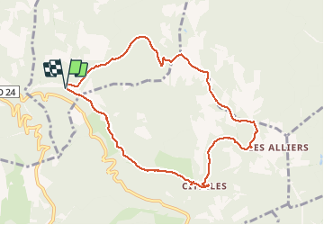
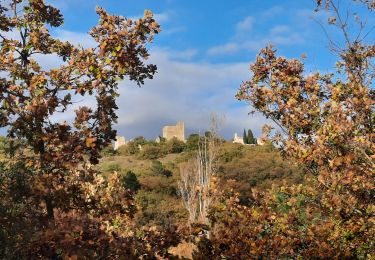
Trail Walking of 9.6 km to be discovered at Auvergne-Rhône-Alpes, Drôme, La Touche. This trail is proposed by thonyc.

Description

Ne pas stationner à côté des maisons mais plutôt en bordure de route près du départ
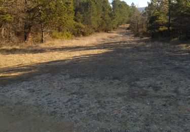
Quelques gués à franchir qui mouilleront bien les chaussures... et les pieds
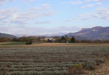
Rando agréable surtout par température élevée (ombre et fraicheur )

Elevation profile

Photos

Positioning

Country:
France
Region :
Auvergne-Rhône-Alpes
Department/Province :
Drôme
Municipality :
La Touche
Location:
Unknown
Start:(UTM)
649488 ; 4929136 (31T) N.

Comments

Please log in to post a review or rate the element


Trails nearby

Trail Walking Portes-en-Valdaine - GPX-Rando-Plaine-Portoise-nouvelleversion - Photo
Walking
GUIDE
thonyc

Walking

Easy
(1)
Portes-en-Valdaine, Auvergne-Rhône-Alpes, Drôme, France
7.1 km | 8.2 km-effort
2h 0min
Yes
Trail Walking Portes-en-Valdaine - Portes-en-Valdaine Serre-de-Mirabel 11km. - Photo
Walking
chancha

Walking

Difficult
(1)
Portes-en-Valdaine, Auvergne-Rhône-Alpes, Drôme, France
10.8 km | 14.7 km-effort
3h 20min
Yes
Trail Mountain bike Puygiron - Puygiron VTT n°5 - Photo
Mountain bike
tracegps

Mountain bike

Very difficult
(1)
Puygiron, Auvergne-Rhône-Alpes, Drôme, France
47 km | 60 km-effort
3h 0min
Yes
Trail Walking La Touche - La Touche Crêtes de l'ysard 12km. - Photo
Walking
chancha

Walking

Difficult
(1)
La Touche, Auvergne-Rhône-Alpes, Drôme, France
12.1 km | 16.8 km-effort
3h 48min
Yes
Trail Walking Portes-en-Valdaine - 26 portes en valdaine - Photo
Walking
GUIDE
randodyssée

Walking

Very easy
Portes-en-Valdaine, Auvergne-Rhône-Alpes, Drôme, France
10.6 km | 14.5 km-effort
4h 10min
Yes
Trail Walking Aleyrac - 26 autour aleyrac - Photo
Walking
GUIDE
randodyssée

Walking

Easy
Aleyrac, Auvergne-Rhône-Alpes, Drôme, France
12.4 km | 15.7 km-effort
4h 50min
No
Trail Walking La Bégude-de-Mazenc - La Bégude de Mazenc - Serre de Forillon - Photo
Walking
tracegps

Walking

Medium
(1)
La Bégude-de-Mazenc, Auvergne-Rhône-Alpes, Drôme, France
8.1 km | 12 km-effort
2h 30min
Yes
Trail Walking Puygiron - 26 Puygiron au coucher du soleil  - Photo
Walking
Maryma

Walking

Medium
Puygiron, Auvergne-Rhône-Alpes, Drôme, France
5.7 km | 8.1 km-effort
1h 50min
Yes
Trail Walking Rochefort-en-Valdaine - tmpWriteApidae_267713_fr - Photo
Walking
GUIDE
thonyc

Walking

Easy
Rochefort-en-Valdaine, Auvergne-Rhône-Alpes, Drôme, France
7.3 km | 10.3 km-effort
2h 30min
Yes


Close
My subscriptions