


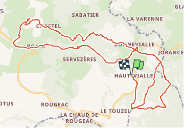

82 km | 119 km-effort

User


FREE GPS app for hiking
 SityTrail
IGN / Geographical institutes
SityTrail World
The world is yours!
Trail Walking of 16.8 km to be discovered at Auvergne-Rhône-Alpes, Haute-Loire, Rosières. This trail is proposed by GilGry.
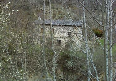
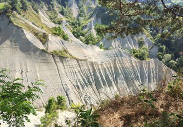
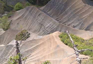
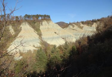
Départ de Haute-Vialle - Erreur de tracé dans mon gps qui m'a fait rogner 4 kms qui seront récupérés. Descente jusqu'à Bonnevialle puis jusqu'aux ravins de Corboeuf. Retour le long de la Suissesse, ascension du Mont Malacoste, déviation Suc de Jorance et Mont gros (que j'aurai du faire à l'aller.
La prochaine fois je fais une boucle sans me planter


sport
Walking

Walking
Walking

Mountain bike
Walking
Walking
Walking
Walking