Trail Mountain bike Yssingeaux - variante par la chapelle de glavenas - Photo

variante par la chapelle de glavenas

© OpenStreetMap contributors
Length
Length
26 km
Max alt
Max alt
962 m
Uphill gradient
Uphill gradient
705 m
Km-Effort
Km-Effort  
35 km
Min alt
Min alt
750 m
Downhill gradient
Downhill gradient
624 m
Boucle
Boucle
No
Creation date :
2020-01-10 13:26:13.969
Updated on :
2020-01-10 16:23:26.226

(0 Reviews)

Mountain bike
Mountain bike
2h00
Difficulty : Medium

Scan this QR Code to open this trail in the SityTrail application

FREE GPS app for hiking

Logo SityTrail SityTrail

IGN / Geographical institutes

Download SityTrail from the App Store Download SityTrail from Google Play

Logo SityTrail SityTrail World

The world is yours!

Download SityTrail from the App Store Download SityTrail from Google Play Download SityTrail on Huawei AppGallery

About

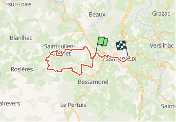
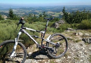
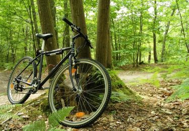
Trail Mountain bike of 26 km to be discovered at Auvergne-Rhône-Alpes, Haute-Loire, Yssingeaux. This trail is proposed by philippe crouzet.

Description

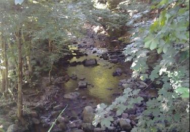
la montée a la chapelle est assez compliquée !!
sinon belle ballade

Elevation profile

Positioning

Country:
France
Region :
Auvergne-Rhône-Alpes
Department/Province :
Haute-Loire
Municipality :
Yssingeaux
Location:
Unknown
Start:(UTM)
585789 ; 5000109 (31T) N.

Trails nearby

Trail Walking Yssingeaux - 43 Yssingeaux 3sucs 9km 300m - Photo
Walking
SyMA

Walking

Very easy
Yssingeaux, Auvergne-Rhône-Alpes, Haute-Loire, France
9.2 km | 13.5 km-effort
2h 59min
Yes
Trail Walking Rosières - 2020-02-21 13:18:03 Chronomètre - Photo
Walking
GilGry

Walking

Very difficult
Rosières, Auvergne-Rhône-Alpes, Haute-Loire, France
16.8 km | 26 km-effort
5h 25min
Yes
Trail Walking Yssingeaux - Yssingeaux - Photo
Walking
belleney

Walking

Very easy
Yssingeaux, Auvergne-Rhône-Alpes, Haute-Loire, France
8 km | 0 m-effort
2h 5min
Yes
Trail Mountain bike Yssingeaux - sortie rapide - Photo
Mountain bike
vinch

Mountain bike

Difficult
Yssingeaux, Auvergne-Rhône-Alpes, Haute-Loire, France
18 km | 24 km-effort
1h 34min
Yes
Trail Mountain bike Yssingeaux - virée des sucs  - Photo
Mountain bike
vinch

Mountain bike

Difficult
Yssingeaux, Auvergne-Rhône-Alpes, Haute-Loire, France
46 km | 63 km-effort
2h 54min
Yes
Trail Mountain bike Yssingeaux - Espace VTT FFC Le Velay des 3 Rivières - N°35 Les Sucs - Yssingeaux - Photo
Mountain bike
tracegps

Mountain bike

Difficult
Yssingeaux, Auvergne-Rhône-Alpes, Haute-Loire, France
28 km | 38 km-effort
3h 30min
Yes
Trail Mountain bike Yssingeaux - Espace VTT FFC Le Velay des 3 Rivières - N°31 Les Cinq Villages Yssingeaux - Photo
Mountain bike
tracegps

Mountain bike

Difficult
Yssingeaux, Auvergne-Rhône-Alpes, Haute-Loire, France
21 km | 27 km-effort
2h 15min
Yes
Trail Walking Beaux - 01 - Photo
Walking
ccmirage

Walking

Difficult
Beaux, Auvergne-Rhône-Alpes, Haute-Loire, France
9.2 km | 13.4 km-effort
1h 21min
No
Trail Walking Saint-Julien-du-Pinet - GR 40_7 - Photo
Walking
Laverret

Walking

Difficult
Saint-Julien-du-Pinet, Auvergne-Rhône-Alpes, Haute-Loire, France
16.1 km | 22 km-effort
7h 34min
No


Close
My subscriptions