Trail Walking Viscomtat - La Virée des Rocs Nº2/Rocher de Pierre Beille - Photo

La Virée des Rocs Nº2/Rocher de Pierre Beille

© OpenStreetMap contributors
Length
Length
16.1 km
Max alt
Max alt
1021 m
Uphill gradient
Uphill gradient
540 m
Km-Effort
Km-Effort  
23 km
Min alt
Min alt
662 m
Downhill gradient
Downhill gradient
542 m
Boucle
Boucle
Yes
Creation date :
2019-09-29 07:00:16.0
Updated on :
2019-09-29 12:44:33.895

(0 Reviews)

Walking
Walking
4h45
Difficulty : Difficult

Scan this QR Code to open this trail in the SityTrail application

FREE GPS app for hiking

Logo SityTrail SityTrail

IGN / Geographical institutes

Download SityTrail from the App Store Download SityTrail from Google Play

Logo SityTrail SityTrail World

The world is yours!

Download SityTrail from the App Store Download SityTrail from Google Play Download SityTrail on Huawei AppGallery

About

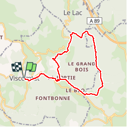
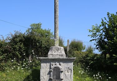
Trail Walking of 16.1 km to be discovered at Auvergne-Rhône-Alpes, Puy-de-Dôme, Viscomtat. This trail is proposed by boulinevelyne.

Description

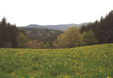
Randonnée de forêts.
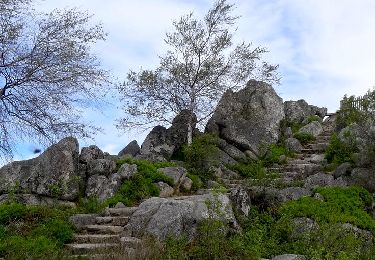
Seule difficulté, la montée sur La Croix du crash de la Caravelle en 10/1972 (pierreuse et abrupte)

Elevation profile

Photos

Positioning

Country:
France
Region :
Auvergne-Rhône-Alpes
Department/Province :
Puy-de-Dôme
Municipality :
Viscomtat
Location:
Unknown
Start:(UTM)
552513 ; 5075112 (31T) N.

Trails nearby

Trail On foot Celles-sur-Durolle - Le Puy d'Oscot - Photo
On foot
PRO

On foot

Medium
Celles-sur-Durolle, Auvergne-Rhône-Alpes, Puy-de-Dôme, France
15.2 km | 22 km-effort
4h 59min
Yes
Trail On foot Vollore-Montagne - Pierre Pamole - Photo
On foot
PRO

On foot

Medium
Vollore-Montagne, Auvergne-Rhône-Alpes, Puy-de-Dôme, France
15.5 km | 22 km-effort
4h 57min
Yes
Trail On foot Vollore-Ville - Le Grun de Chignore - Photo
On foot
PRO

On foot

Medium
Vollore-Ville, Auvergne-Rhône-Alpes, Puy-de-Dôme, France
15.1 km | 24 km-effort
5h 27min
No
Trail Walking Noirétable - De Notre Dame L’héritage a Chabreloche  - Photo
Walking
NANE51

Walking

Medium
Noirétable, Auvergne-Rhône-Alpes, Loire, France
18.6 km | 26 km-effort
6h 6min
No
Trail Walking Sainte-Agathe - Ste_Agathe_Peage - Photo
Walking
GUIDE
jagarnier

Walking

Medium
Sainte-Agathe, Auvergne-Rhône-Alpes, Puy-de-Dôme, France
11.1 km | 16.4 km-effort
3h 15min
Yes
Trail Walking Vollore-Montagne - Vollore_Pierre_Pamole - Photo
Walking
GUIDE
jagarnier

Walking

Medium
Vollore-Montagne, Auvergne-Rhône-Alpes, Puy-de-Dôme, France
16.5 km | 23 km-effort
5h 15min
Yes
Trail Walking Sainte-Agathe - Saint agate 3ieme jour - Photo
Walking
jpdroux

Walking

Difficult
Sainte-Agathe, Auvergne-Rhône-Alpes, Puy-de-Dôme, France
11.6 km | 16.1 km-effort
4h 45min
Yes
Trail Walking Celles-sur-Durolle - Celles_Puy_Oscot - Photo
Walking
GUIDE
jagarnier

Walking

Medium
Celles-sur-Durolle, Auvergne-Rhône-Alpes, Puy-de-Dôme, France
15.5 km | 22 km-effort
4h 40min
Yes
Trail Walking Sainte-Agathe - Le Péage - Livradois Forez - Photo
Walking
tracegps

Walking

Medium
Sainte-Agathe, Auvergne-Rhône-Alpes, Puy-de-Dôme, France
12.1 km | 17.4 km-effort
3h 0min
Yes


Close
My subscriptions