Trail Bicycle tourism Saint-Pé-de-Bigorre - St-Pé-de-Bigorre - Oloron - Photo
© OpenStreetMap contributors
Length
Length
62 km
Max alt
Max alt
498 m
Uphill gradient
Uphill gradient
886 m
Km-Effort
Km-Effort  
74 km
Min alt
Min alt
214 m
Downhill gradient
Downhill gradient
1020 m
Boucle
Boucle
No
Creation date :
2019-07-03 07:25:31.003
Updated on :
2019-07-03 15:17:22.106

(0 Reviews)

Bicycle tourism
Bicycle tourism
3h54
Difficulty : Difficult

Scan this QR Code to open this trail in the SityTrail application

FREE GPS app for hiking

Logo SityTrail SityTrail

IGN / Geographical institutes

Download SityTrail from the App Store Download SityTrail from Google Play

Logo SityTrail SityTrail World

The world is yours!

Download SityTrail from the App Store Download SityTrail from Google Play Download SityTrail on Huawei AppGallery

About

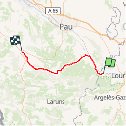
Trail Bicycle tourism of 62 km to be discovered at Occitania, Hautespyrenees, Saint-Pé-de-Bigorre. This trail is proposed by karawatsj.

Description

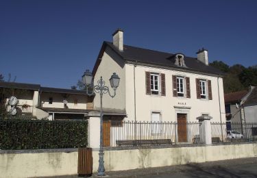
We steken de Pau over die we volgen tot in Nay. Hier verlaten we de Pau en stijgen naar een golvend plateau tussen Gave de Pau en Gave d'Ossau. Eventjes flink klimmen.

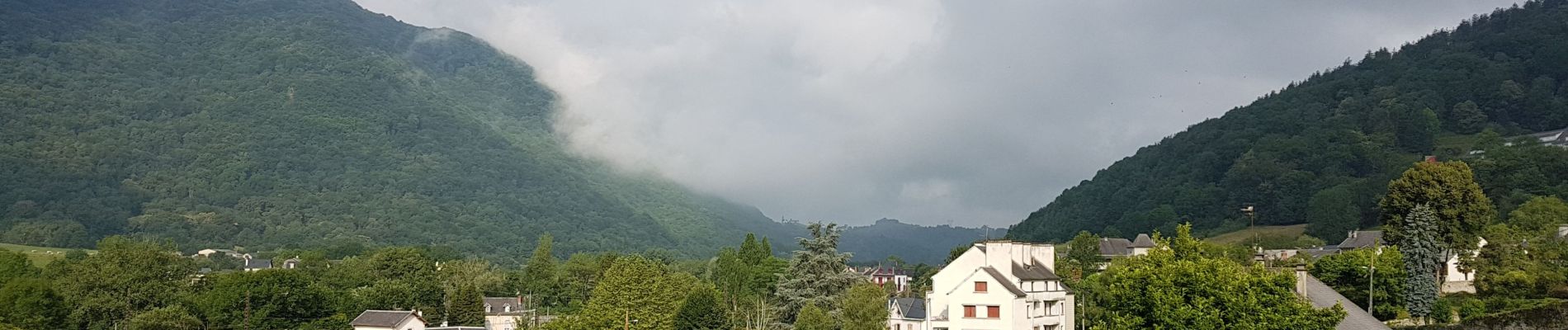
Er is lage bewolking maar hier en daar komt toch de zon te voorschijn.  De hoogste bergtoppen blijven verborgen. Mooi, ontspannend en uitermate rustig fietsen.

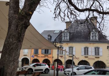
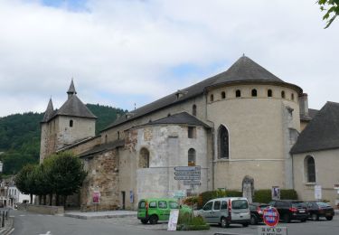
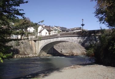
We dalen af naar Arudy. We steken de Gave d'Ossau over en rijden naar het centrum met gezellig stadspleintje. Een frisdrankje en even rust. We volgen de Ossau nog even maar dan stijgen we terug en klimmen door het prachtige Bois du Bager naar een col waar we onze casse-croûte nemen op een bankje nabij een boshut. Als we het bos uitrijden bevinden we ons op de rue des crêtes. De lucht is gedeeltelijk opgeklaard en ver weg kunnen we besneeuwde bergtoppen ontwaren.

Wat later dalen we terug af naar Oloron.

Elevation profile

Photos

Positioning

Country:
France
Region :
Occitania
Department/Province :
Hautespyrenees
Municipality :
Saint-Pé-de-Bigorre
Location:
Unknown
Start:(UTM)
731175 ; 4776183 (30T) N.

Trails nearby

Trail On foot Saint-Pé-de-Bigorre - SAINT PE DE BIGORRE Le grand tour de saint pe
On foot
GUIDE
marmotte65

On foot

Easy
Saint-Pé-de-Bigorre, Occitania, Hautespyrenees, France
9.8 km | 13.6 km-effort
3h 5min
Yes
Trail On foot Saint-Pé-de-Bigorre - Le Plateau du Mousqué - Photo
On foot
PRO

On foot

Easy
Saint-Pé-de-Bigorre, Occitania, Hautespyrenees, France
5.1 km | 7.8 km-effort
1h 45min
Yes
Trail On foot Peyrouse - Le Chemin du Bédouret - Photo
On foot
PRO

On foot

Easy
Peyrouse, Occitania, Hautespyrenees, France
4.1 km | 6.6 km-effort
1h 29min
Yes
Trail On foot Saint-Pé-de-Bigorre - Lengous et Montagnou - Photo
On foot
PRO

On foot

Easy
Saint-Pé-de-Bigorre, Occitania, Hautespyrenees, France
5.3 km | 7.4 km-effort
1h 40min
Yes
Trail On foot Saint-Pé-de-Bigorre - Les Coteaux de Saint-Pé - Photo
On foot
PRO

On foot

Easy
Saint-Pé-de-Bigorre, Occitania, Hautespyrenees, France
9.2 km | 12.2 km-effort
2h 46min
Yes
Trail Walking Saint-Pé-de-Bigorre - SAINT PE de BIGORRE et ses côteaux G4  faite avec LPC
Walking
GUIDE
marmotte65

Walking

Medium
Saint-Pé-de-Bigorre, Occitania, Hautespyrenees, France
9 km | 12.5 km-effort
2h 40min
Yes
Trail Walking Saint-Pé-de-Bigorre - Les Soums Saint-Péens - Saint Pé de Bigorre - Photo
Walking
tracegps

Walking

Difficult
(1)
Saint-Pé-de-Bigorre, Occitania, Hautespyrenees, France
15.3 km | 31 km-effort
7h 0min
Yes
Trail Walking Lestelle-Bétharram - 2023 10 10 CHEMIN du PIÉMONT PYRÉNÉEN - 18ème étape : Lestelle-Bétharram - Asson - Bruges - Mifaget - Ste Colome - Arudy - Photo
Walking
LEGUE

Walking

Medium
Lestelle-Bétharram, New Aquitaine, Pyrénées-Atlantiques, France
28 km | 36 km-effort
6h 9min
No
Trail On foot Saint-Pé-de-Bigorre - Le sentier du Bénac - Photo
On foot
PRO

On foot

Easy
Saint-Pé-de-Bigorre, Occitania, Hautespyrenees, France
8.1 km | 14.3 km-effort
3h 14min
Yes


Close
My subscriptions