SityTrail - GRP CV-IDF
clalaur
User
Length
27 km
Max alt
120 m
Uphill gradient
249 m
Km-Effort
30 km
Min alt
43 m
Downhill gradient
214 m
Boucle
No
Creation date :
2018-06-04 15:53:44.266
Updated on :
2018-12-29 11:46:24.47
6h45
Difficulty : Difficult
FREE GPS app for hiking
About
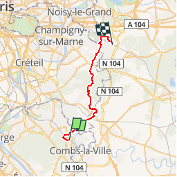
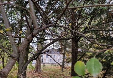
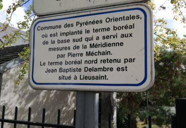
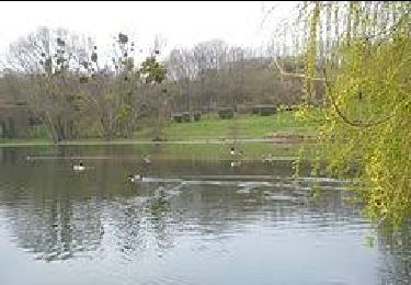
Trail Walking of 27 km to be discovered at Ile-de-France, Essonne, Boussy-Saint-Antoine. This trail is proposed by clalaur.
Description
Ceinture verte de l'Ile de France - Etape 5 sur 16 - De Gare de Boussy-St-Antoine (RER D) a Gare d'Emerainville Pontault Combault (RER E)
Positioning
Country:
France
Region :
Ile-de-France
Department/Province :
Essonne
Municipality :
Boussy-Saint-Antoine
Location:
Unknown
Start:(Dec)
Start:(UTM)
465597 ; 5392088 (31U) N.
Comments
Trails nearby
GRP CV-IDF 04
Walking
Difficult
(1)
Boussy-Saint-Antoine,
Ile-de-France,
Essonne,
France
16.8 km | 18.6 km-effort
4h 13min
No
J 26 Mandres, Boussy , Brunoy le chemin des fresques
Walking
Medium
(2)
Mandres-les-Roses,
Ile-de-France,
Val-de-Marne,
France
12.2 km | 13.8 km-effort
3h 7min
Yes
J 01 11.97 km les 5 châteaux
On foot
Medium
(1)
Servon,
Ile-de-France,
Seine-et-Marne,
France
11.7 km | 13.2 km-effort
3h 3min
Yes
R 04 - 8 km - Servon, Santeny, Servon
On foot
Very difficult
(4)
Servon,
Ile-de-France,
Seine-et-Marne,
France
7.9 km | 9.1 km-effort
2h 3min
Yes
L 23 Lieusaint, ruisseau des Heauldres, canal d'Ormoy
On foot
Very easy
(3)
Tigery,
Ile-de-France,
Essonne,
France
5.1 km | 5.4 km-effort
1h 14min
Yes
Ru des Hauldres
Walking
Medium
(1)
Tigery,
Ile-de-France,
Essonne,
France
8.7 km | 9.3 km-effort
2h 7min
Yes
L 39 Brunoy, les bords de l'Yerres
On foot
Very easy
(4)
Brunoy,
Ile-de-France,
Essonne,
France
5.4 km | 6.1 km-effort
1h 49min
Yes
J 38 Montgeron la Pelouse, forêt de Sénart
Walking
Difficult
(3)
Montgeron,
Ile-de-France,
Essonne,
France
12.4 km | 13.3 km-effort
3h 1min
Yes
J 77 Tigery, Allée Royale
On foot
Medium
(3)
Quincy-sous-Sénart,
Ile-de-France,
Essonne,
France
10.6 km | 12 km-effort
2h 44min
Yes