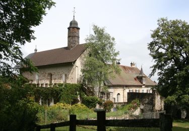
Trail Winter sports Bulle - Bulle - Rathwel - Photo
© OpenStreetMap contributors
Length
Length
36 km
Max alt
Max alt
1346 m
Uphill gradient
Uphill gradient
1100 m
Km-Effort
Km-Effort  
50 km
Min alt
Min alt
780 m
Downhill gradient
Downhill gradient
1103 m
Boucle
Boucle
Yes
Creation date :
2014-12-11 00:00:00.0
Updated on :
2014-12-11 00:00:00.0

(0 Reviews)

Winter sports
Winter sports
--
Difficulty : Unknown

Scan this QR Code to open this trail in the SityTrail application

FREE GPS app for hiking

Logo SityTrail SityTrail

IGN / Geographical institutes

Download SityTrail from the App Store Download SityTrail from Google Play

Logo SityTrail SityTrail World

The world is yours!

Download SityTrail from the App Store Download SityTrail from Google Play Download SityTrail on Huawei AppGallery

About

Trail Winter sports of 36 km to be discovered at Fribourg, Gruyère District, Bulle. This trail is proposed by vttnature.

Description

Longueur : 37 Km
Dénivelée positive : 980 m
Altitude de départ : 765 m
Altitude maximale : 1335 m

Course en moyenne altitude, ombragée et sans difficulté majeure

Topo : Du parc d''Espace Gruyère, suivre la rue de Vevey en direction de la Chia. A 1,5 Km, à la hauteur d''un hangar de l''armée, prendre à droite puis à gauche en direction des Citards. Après le club de modèles réduits, suivre la direction des Portes. Poursuivre la route jusqu''au dernier lacet avant les Portes d''en Haut. Prendre le chemin gravelé et le suivre jusqu''à la route des Alpettes venant de Semsales. Poursuivre en direction des Prévondes. Continuer par le chemin. A la fin de celui-ci, descendre vers le ruisseau. Quelques petits portages en direction de la Moille Progin et la route reprend. Suivre cette dernière jusqu''au deuxième croisement et prendre à gauche en direction du Rathwel. Après ce dernier, prendre à gauche et descendre la vallée de la Trême pour rejoindre Bulle.

Elevation profile

Positioning

Country:
Switzerland
Region :
Fribourg
Department/Province :
Gruyère District
Municipality :
Bulle
Location:
Unknown
Start:(UTM)
350613 ; 5164155 (32T) N.

Trails nearby

Trail Walking Bulle - Broc FR - Notre Dame des Marches - Photo
Walking
furggstalden

Walking

Very easy
(1)
Bulle, Fribourg, Gruyère District, Switzerland
14.3 km | 19.7 km-effort
4h 37min
Yes
Trail On foot Gruyères - Sentier des Pauvres - Photo
On foot
GUIDE+

On foot

Easy
Gruyères, Fribourg, Gruyère District, Switzerland
5.9 km | 8.5 km-effort
1h 55min
No
Trail Cycle Gruyères - st_ral_5 - Photo
Cycle
GUIDE+

Cycle

Very easy
Gruyères, Fribourg, Gruyère District, Switzerland
34 km | 55 km-effort
Unknown
No
Trail Walking Marsens - st_bg_villars2 - Photo
Walking
GUIDE+

Walking

Very easy
Marsens, Fribourg, Gruyère District, Switzerland
136 km | 206 km-effort
Unknown
No
Trail Walking Broc - Gorges de la Jogne, lac de Montsalvens circuit 07.04.17 - Photo
Walking
duamerg

Walking

Medium
Broc, Fribourg, Gruyère District, Switzerland
12.6 km | 19 km-effort
4h 17min
Yes
Trail Walking Bulle - Bulle-Le Vissieu-Bulle - Photo
Walking

Walking

Easy
Bulle, Fribourg, Gruyère District, Switzerland
6.5 km | 8.7 km-effort
2h 14min
Yes
Trail Walking Corbières - Corbières-Impart-Le Ruz-Hauteville - Photo
Walking
rene.esseiva

Walking

Medium
Corbières, Fribourg, Gruyère District, Switzerland
7.8 km | 10.8 km-effort
2h 27min
Yes
Trail Walking Bulle - Bulle-Le Vissieu-Bulle - Photo
Walking
rene.esseiva

Walking

Easy
Bulle, Fribourg, Gruyère District, Switzerland
6.5 km | 8.7 km-effort
2h 14min
Yes
Trail Walking Bulle - Bulle - Le Vessieu - Bois de Bouleyres - Photo
Walking
gpiller

Walking

Very easy
Bulle, Fribourg, Gruyère District, Switzerland
6.8 km | 8.9 km-effort
2h 0min
Yes


Close
My subscriptions