Trail Mountain bike Lorgies - VTT autour de Lorgies - Photo

VTT autour de Lorgies

 tracegps
tracegps

User

© OpenStreetMap contributors
Length
Length
18.6 km
Max alt
Max alt
42 m
Uphill gradient
Uphill gradient
86 m
Km-Effort
Km-Effort  
19.7 km
Min alt
Min alt
16 m
Downhill gradient
Downhill gradient
86 m
Boucle
Boucle
Yes
Creation date :
2014-12-10 00:00:00.0
Updated on :
2014-12-10 00:00:00.0

(0 Reviews)

Mountain bike
Mountain bike
1h10
Difficulty : Easy

Scan this QR Code to open this trail in the SityTrail application

FREE GPS app for hiking

Logo SityTrail SityTrail

IGN / Geographical institutes

Download SityTrail from the App Store Download SityTrail from Google Play

Logo SityTrail SityTrail World

The world is yours!

Download SityTrail from the App Store Download SityTrail from Google Play Download SityTrail on Huawei AppGallery

About

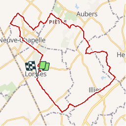
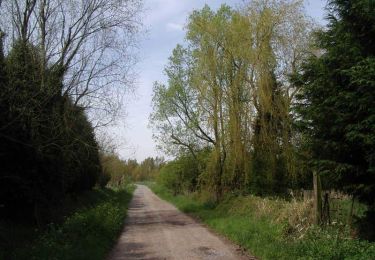
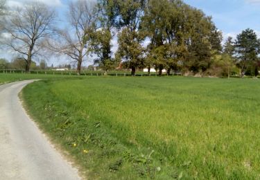
Trail Mountain bike of 18.6 km to be discovered at Hauts-de-France, Pas-de-Calais, Lorgies. This trail is proposed by tracegps.

Description

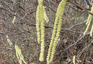
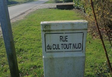
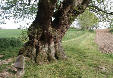
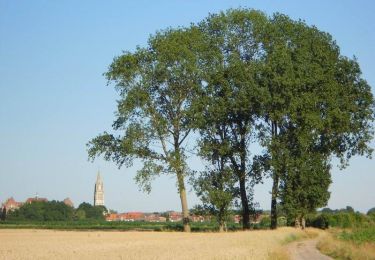
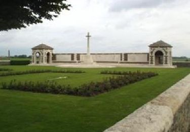
Circuit facile au départ de l'église de Lorgies à travers les Weppes. Les blockhaus de la première guerre mondiale rappellent les combats qui ont détruits la plupart des villages des environs. Le tilleul du Joncquoy à Aubers (15eme siècle) échappa à la destruction.

Elevation profile

Photos

Positioning

Country:
France
Region :
Hauts-de-France
Department/Province :
Pas-de-Calais
Municipality :
Lorgies
Location:
Unknown
Start:(UTM)
485220 ; 5601745 (31U) N.

Trails nearby

Trail Walking La Bassée - La Basée 13 km - Photo
Walking
GUIDE
rvapeldo

Walking

Easy
La Bassée, Hauts-de-France, Nord, France
13 km | 13.7 km-effort
3h 26min
Yes
Trail Walking Richebourg - rando richebourg  - Photo
Walking
Chene62

Walking

Medium
Richebourg, Hauts-de-France, Pas-de-Calais, France
21 km | 22 km-effort
3h 51min
Yes
Trail Walking Aubers - Aubert 7.6 km Circuit du tilleul du Joncquoy - Photo
Walking
Blourouce

Walking

Medium
Aubers, Hauts-de-France, Nord, France
7.6 km | 8.2 km-effort
2h 0min
Yes
Trail Walking Violaines - Le Canteleu - Violaines  - Photo
Walking
tracegps

Walking

Medium
Violaines, Hauts-de-France, Pas-de-Calais, France
14.7 km | 15.4 km-effort
3h 40min
Yes
Trail Walking Fromelles - Circuit des étangs des Weppes - Photo
Walking

Walking

Very easy
Fromelles, Hauts-de-France, Nord, France
10.8 km | 11.5 km-effort
Unknown
Yes
Trail Walking Aubers - Circuit du tilleul du Joncquoy - Photo
Walking
tracegps

Walking

Medium
Aubers, Hauts-de-France, Nord, France
7.6 km | 8.2 km-effort
2h 0min
Yes
Trail Walking Fromelles - Circuit de la bataille de Fromelles - Photo
Walking
tracegps

Walking

Medium
(1)
Fromelles, Hauts-de-France, Nord, France
9.7 km | 10.3 km-effort
2h 30min
Yes
Trail Walking Herlies - La Crapahute17/04/17 - Photo
Walking
roclem421

Walking

Very easy
Herlies, Hauts-de-France, Nord, France
10.5 km | 11.2 km-effort
2h 0min
Yes
Trail Cycle Fromelles - Les Weppes - Fromelles - Photo
Cycle
tracegps

Cycle

Medium
Fromelles, Hauts-de-France, Nord, France
36 km | 39 km-effort
3h 0min
Yes


Close
My subscriptions