Trail Mountain bike Ostricourt - Autour d'Ostricourt - Photo

Autour d'Ostricourt

 scotte
scotte

User

© OpenStreetMap contributors
Length
Length
63 km
Max alt
Max alt
76 m
Uphill gradient
Uphill gradient
531 m
Km-Effort
Km-Effort  
70 km
Min alt
Min alt
19 m
Downhill gradient
Downhill gradient
531 m
Boucle
Boucle
Yes
Creation date :
2014-12-10 00:00:00.0
Updated on :
2014-12-10 00:00:00.0

(0 Reviews)

Mountain bike
Mountain bike
4h00
Difficulty : Medium

Scan this QR Code to open this trail in the SityTrail application

FREE GPS app for hiking

Logo SityTrail SityTrail

IGN / Geographical institutes

Download SityTrail from the App Store Download SityTrail from Google Play

Logo SityTrail SityTrail World

The world is yours!

Download SityTrail from the App Store Download SityTrail from Google Play Download SityTrail on Huawei AppGallery

About

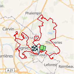
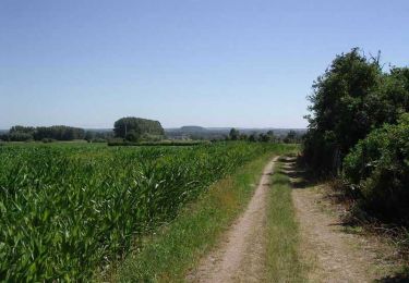
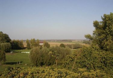
Trail Mountain bike of 63 km to be discovered at Hauts-de-France, Nord, Ostricourt. This trail is proposed by scotte.

Description

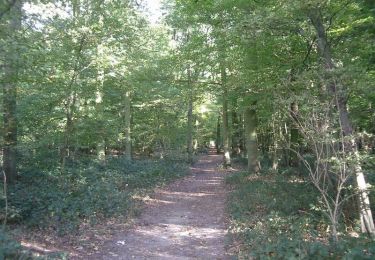
Balade sportive autour d'Ostricourt ralliant les terrils de Carvin, Le Forest et Ostricourt en passant par la forêt de Phalempin.

Elevation profile

Points of interest

Point of interest Libercourt - Grille - Photo
scotte
LIBERCOURT 

Positioning

Country:
France
Region :
Hauts-de-France
Department/Province :
Nord
Municipality :
Ostricourt
Location:
Unknown
Start:(UTM)
502173 ; 5589176 (31U) N.

Trails nearby

Trail Walking Mons-en-Pévèle - Autour du site ornithologique du bois des Cinq Tailles  - Mons en Pévèle - Photo
Walking
tracegps

Walking

Medium
(4)
Mons-en-Pévèle, Hauts-de-France, Nord, France
11.2 km | 12.8 km-effort
2h 49min
Yes
Trail Walking Mons-en-Pévèle - le paradis de mons en pévèle - Photo
Walking
dehemjacques

Walking

Easy
(1)
Mons-en-Pévèle, Hauts-de-France, Nord, France
8.6 km | 9.8 km-effort
2h 15min
Yes
Trail Walking Auby - boucle des 3 cavaliers départ Auby - Photo
Walking
janfil

Walking

Very difficult
(1)
Auby, Hauts-de-France, Nord, France
23 km | 25 km-effort
6h 6min
Yes
Trail Walking Auby - boucle Auby - Port d'eau Courcelles-lès-Lens - Photo
Walking
janfil

Walking

Medium
Auby, Hauts-de-France, Nord, France
10.1 km | 10.8 km-effort
2h 10min
Yes
Trail On foot Oignies - oignies et le parc des hautois - Photo
On foot
Templeuveenmarche

On foot

Medium
(1)
Oignies, Hauts-de-France, Pas-de-Calais, France
9.8 km | 11.1 km-effort
Unknown
Yes
Trail Nordic walking Leforest - ostricourt - Photo
Nordic walking
ancar

Nordic walking

Very easy
(1)
Leforest, Hauts-de-France, Pas-de-Calais, France
6.6 km | 7.7 km-effort
1h 26min
Yes
Trail Walking Mons-en-Pévèle - circuit des chapelles mons en pevele - Photo
Walking
dehemjacques

Walking

Medium
(4)
Mons-en-Pévèle, Hauts-de-France, Nord, France
13.3 km | 14.8 km-effort
3h 17min
Yes
Trail Walking Moncheaux - Circuit de Moncheaux - Photo
Walking
tracegps

Walking

Medium
Moncheaux, Hauts-de-France, Nord, France
11.1 km | 12.2 km-effort
2h 45min
Yes
Trail Walking Mons-en-Pévèle - Autour du Paris-Roubaix - Mons-en Pévèle - Photo
Walking
tracegps

Walking

Easy
Mons-en-Pévèle, Hauts-de-France, Nord, France
6.2 km | 7.1 km-effort
1h 34min
Yes


Close
My subscriptions