Trail Walking Jarrier - le grand Chatelard - Photo
 Gorki
Gorki

User

© OpenStreetMap contributors
Length
Length
4.5 km
Max alt
Max alt
2129 m
Uphill gradient
Uphill gradient
596 m
Km-Effort
Km-Effort  
10.5 km
Min alt
Min alt
1525 m
Downhill gradient
Downhill gradient
2 m
Boucle
Boucle
No
Creation date :
2014-12-10 00:00:00.0
Updated on :
2014-12-10 00:00:00.0

(4 Reviews)

Walking
Walking
2h31
Difficulty : Very easy

Scan this QR Code to open this trail in the SityTrail application

FREE GPS app for hiking

Logo SityTrail SityTrail

IGN / Geographical institutes

Download SityTrail from the App Store Download SityTrail from Google Play

Logo SityTrail SityTrail World

The world is yours!

Download SityTrail from the App Store Download SityTrail from Google Play Download SityTrail on Huawei AppGallery

About

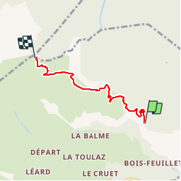
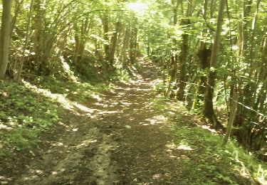
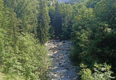
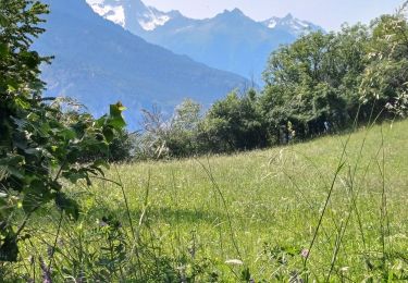
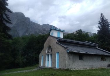
Trail Walking of 4.5 km to be discovered at Auvergne-Rhône-Alpes, Savoy, Jarrier. This trail is proposed by Gorki.

Elevation profile

Photos

Positioning

Country:
France
Region :
Auvergne-Rhône-Alpes
Department/Province :
Savoy
Municipality :
Jarrier
Location:
Unknown
Start:(UTM)
290337 ; 5018737 (32T) N.

Comments

Please log in to post a review or rate the element


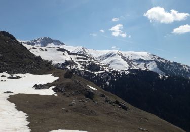
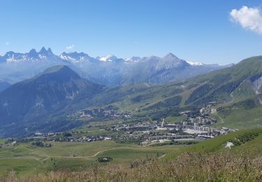
balade facile avec super point de vue au sommet


Trails nearby

Trail Mountain bike La Tour-en-Maurienne - Le châtel-Le Chaussy-Le Melezet - Photo
Mountain bike
FERAUD

Mountain bike

Medium
(3)
La Tour-en-Maurienne, Auvergne-Rhône-Alpes, Savoy, France
22 km | 36 km-effort
2h 17min
Yes
Trail Road bike Saint-Alban-des-Villards - col du Glandon et de la croix de fer en boucle  - Photo
Road bike
GUIDE
nadd73

Road bike

Difficult
Saint-Alban-des-Villards, Auvergne-Rhône-Alpes, Savoy, France
63 km | 92 km-effort
4h 35min
Yes
Trail Snowshoes Fontcouverte-la-Toussuire - la Toussuire  - cret Morandet -le grand Truc  - Photo
Snowshoes
GUIDE
GEGERANDO17

Snowshoes

Very easy
Fontcouverte-la-Toussuire, Auvergne-Rhône-Alpes, Savoy, France
6.4 km | 13.2 km-effort
2h 53min
Yes
Trail Walking La Tour-en-Maurienne - Le Golet - Montandre- chapelle de Grenis - Photo
Walking
GUIDE
GEGERANDO17

Walking

Medium
La Tour-en-Maurienne, Auvergne-Rhône-Alpes, Savoy, France
6.2 km | 12 km-effort
1h 53min
Yes
Trail Road bike Saint-Jean-de-Maurienne - Chaburtan - Photo
Road bike
GUIDE
nadd73

Road bike

Medium
Saint-Jean-de-Maurienne, Auvergne-Rhône-Alpes, Savoy, France
47 km | 64 km-effort
5h 43min
Yes
Trail Walking Jarrier - le chatelard - Photo
Walking
GUIDE
GEGERANDO17

Walking

Very difficult
Jarrier, Auvergne-Rhône-Alpes, Savoy, France
14.2 km | 29 km-effort
5h 41min
Yes
Trail Walking La Tour-en-Maurienne - Hermillon- les Grangettes - Montandre - Photo
Walking
GUIDE
GEGERANDO17

Walking

Medium
La Tour-en-Maurienne, Auvergne-Rhône-Alpes, Savoy, France
11.1 km | 21 km-effort
3h 22min
Yes
Trail Walking La Tour-en-Maurienne - le Chatel- col de la Baisse  - Photo
Walking
GUIDE
GEGERANDO17

Walking

Difficult
La Tour-en-Maurienne, Auvergne-Rhône-Alpes, Savoy, France
13.7 km | 31 km-effort
5h 6min
Yes
Trail Nordic walking Fontcouverte-la-Toussuire - crêtes Toussuire Corbier - Photo
Nordic walking
fb73300

Nordic walking

Difficult
Fontcouverte-la-Toussuire, Auvergne-Rhône-Alpes, Savoy, France
17 km | 32 km-effort
6h 33min
No


Close
My subscriptions