Trail Mountain bike Saint-Martin-du-Fouilloux - Zevtt - St Martin du Fouilloux - Photo
 kipoura
kipoura

User

© OpenStreetMap contributors
Length
Length
56 km
Max alt
Max alt
270 m
Uphill gradient
Uphill gradient
578 m
Km-Effort
Km-Effort  
64 km
Min alt
Min alt
141 m
Downhill gradient
Downhill gradient
576 m
Boucle
Boucle
Yes
Creation date :
2019-05-03 17:11:04.064
Updated on :
2019-05-03 17:11:04.133

(0 Reviews)

Mountain bike
Mountain bike
2h30
Difficulty : Medium

Scan this QR Code to open this trail in the SityTrail application

FREE GPS app for hiking

Logo SityTrail SityTrail

IGN / Geographical institutes

Download SityTrail from the App Store Download SityTrail from Google Play

Logo SityTrail SityTrail World

The world is yours!

Download SityTrail from the App Store Download SityTrail from Google Play Download SityTrail on Huawei AppGallery

About

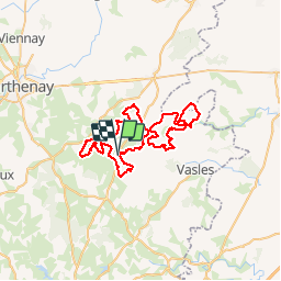
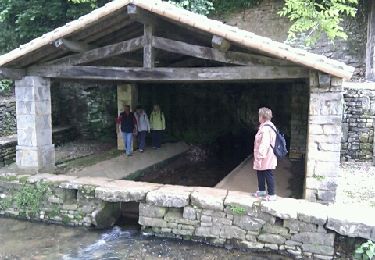
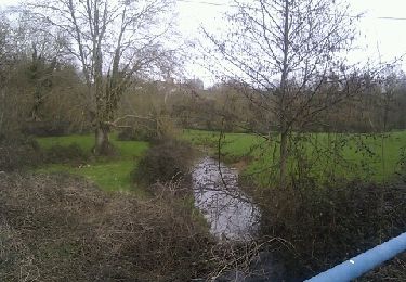
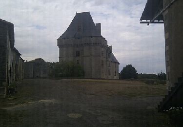
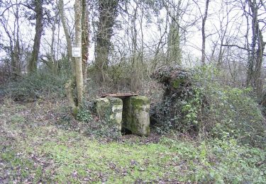
Trail Mountain bike of 56 km to be discovered at New Aquitaine, Deux-Sèvres, Saint-Martin-du-Fouilloux. This trail is proposed by kipoura.

Description

Une boucle VTT des plus sympathique dans la gâtine Deux-sévrienne .... http://zevtt.free.fr

Elevation profile

Positioning

Country:
France
Region :
New Aquitaine
Department/Province :
Deux-Sèvres
Municipality :
Saint-Martin-du-Fouilloux
Location:
Unknown
Start:(UTM)
720478 ; 5163442 (30T) N.

Trails nearby

Trail Walking Lusignan - Sentier de Mélusine à Lusignan - Photo
Walking
tracegps

Walking

Medium
(1)
Lusignan, New Aquitaine, Vienne, France
8.7 km | 10.5 km-effort
2h 30min
Yes
Trail Horseback riding Augé - Bois Aigu Clavé 2 - Photo
Horseback riding
Dom4i

Horseback riding

Very difficult
(1)
Augé, New Aquitaine, Deux-Sèvres, France
40 km | 50 km-effort
6h 32min
Yes
Trail Walking Ayron - Autour d'Ayron  - Photo
Walking
tracegps

Walking

Medium
Ayron, New Aquitaine, Vienne, France
11.7 km | 13.6 km-effort
2h 45min
Yes
Trail Walking Lusignan - JFT YB Etape7 3-05-2014 - Photo
Walking
jeff2

Walking

Easy
Lusignan, New Aquitaine, Vienne, France
38 km | 42 km-effort
7h 49min
No
Trail Walking Saint-Christophe-sur-Roc - St Christophe sur Roc - Photo
Walking
olaze

Walking

Easy
Saint-Christophe-sur-Roc, New Aquitaine, Deux-Sèvres, France
10.9 km | 13 km-effort
2h 49min
Yes
Trail Walking Champdeniers - Champeaux - Photo
Walking
olaze

Walking

Easy
Champdeniers, New Aquitaine, Deux-Sèvres, France
8.1 km | 9.8 km-effort
2h 8min
Yes
Trail Walking Cherveux - Cherveux- 9,1km - Photo
Walking
olaze

Walking

Medium
Cherveux, New Aquitaine, Deux-Sèvres, France
9.1 km | 10.5 km-effort
2h 19min
Yes
Trail Walking Cherveux - Cherveux . (ATSCAF) 10km - Photo
Walking
olaze

Walking

Easy
Cherveux, New Aquitaine, Deux-Sèvres, France
10.1 km | 11.8 km-effort
2h 42min
Yes
Trail Walking Amailloux - Amailloux Sud - Photo
Walking
tracegps

Walking

Easy
Amailloux, New Aquitaine, Deux-Sèvres, France
12.1 km | 13.5 km-effort
2h 30min
Yes


Close
My subscriptions