


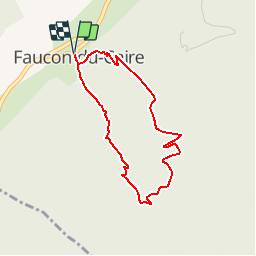

11.8 km | 21 km-effort


User


FREE GPS app for hiking
 SityTrail
IGN / Geographical institutes
SityTrail World
The world is yours!
Trail Walking of 3.5 km to be discovered at Provence-Alpes-Côte d'Azur, Alpes-de-Haute-Provence, Faucon-du-Caire. This trail is proposed by tracegps.
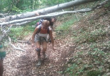
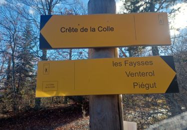
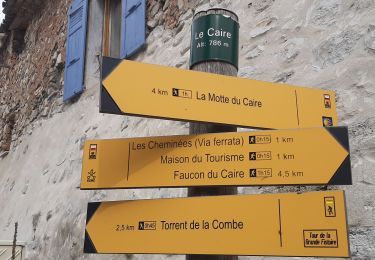
Ce circuit vous est proposé par les Hautes Terres de Provence. Cette randonnée sauvage débute sur le haut du village de Faucon du Caire par un fléchage qui vous indique la direction à suivre durant la première partie de cette boucle, c'est-à-dire Le Caire par le Viéraron. Arrivé dans une belle hêtraie, vous rejoignez une ancienne piste utilisée uniquement par quelques vaches que vous croiserez sans doute. Prendre à gauche et la suivre jusqu’aux abords du ravin de la Piche, qui fut coupé il y a quelques années par un éboulis impressionnant. Descendre dans ce superbe vallon jusqu’au promontoire qui surplombe Faucon du Caire sur lequel jadis un castrum (château) fut érigé. Aujourd’hui, à sa place un Rocher-qui-Parlevous transporte dans d’autres contrées, marquant ainsi l’originalité du lieu et de ses rochers sonores qui jalonnent les Hautes Terres de Provence. Retrouvez cette randonnée sur le site des Hautes Terres de Provence.


Walking
Walking

Walking

Walking
Walking
Walking
Walking

Walking
Walking