Trail Walking Tréhorenteuc - Le val sans retour -  Tréhorenteuc - Photo

Le val sans retour - Tréhorenteuc

 tracegps
tracegps

User

© OpenStreetMap contributors
Length
Length
8.3 km
Max alt
Max alt
189 m
Uphill gradient
Uphill gradient
137 m
Km-Effort
Km-Effort  
10.1 km
Min alt
Min alt
85 m
Downhill gradient
Downhill gradient
137 m
Boucle
Boucle
Yes
Creation date :
2014-12-10 00:00:00.0
Updated on :
2014-12-10 00:00:00.0

(0 Reviews)

Walking
Walking
2h04
Difficulty : Medium

Scan this QR Code to open this trail in the SityTrail application

FREE GPS app for hiking

Logo SityTrail SityTrail

IGN / Geographical institutes

Download SityTrail from the App Store Download SityTrail from Google Play

Logo SityTrail SityTrail World

The world is yours!

Download SityTrail from the App Store Download SityTrail from Google Play Download SityTrail on Huawei AppGallery

About

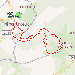
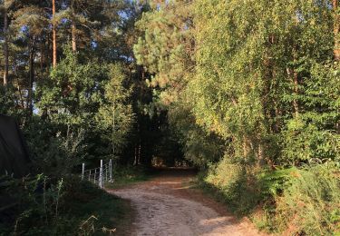
Trail Walking of 8.3 km to be discovered at Brittany, Morbihan, Tréhorenteuc. This trail is proposed by tracegps.

Description

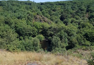
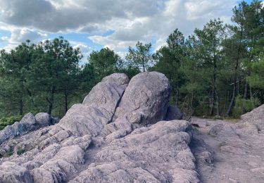
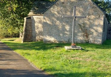
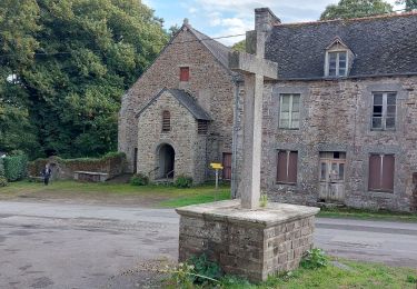
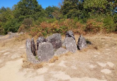
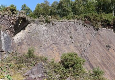
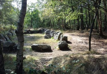
Une trentaine de communes portent le label "Communes du Patrimoine Rural de Bretagne" et mettent en commun leur volonté de sauvegarde, de mise en valeur et d'animation de leur patrimoine architectural et paysager. Des circuits de randonnées pour les uns, des balades champêtres pour les autres vous feront découvrir les bourgs et les villages de caractère de nos communes. L'office de tourisme du Pays de Mauron en Brocéliande à Tréhorenteuc vous invite à venir les rencontrer afin de vous apporter de vive voix de plus amples informations sur les sites et balades à faire dans la belle forêt de Brocéliande. Situé au cœur de la Forêt de Brocéliande, Trehorenteuc a gardé son caractère authentique. Ses légendes et son patrimoine bâti réjouissent les nombreux visiteurs. Sa nature encore préservée se laisse découvrir grâce à ses nombreux sentiers de randonnées. L'Arbre d'Or, le Val sans Retour sont des balades merveilleuses en toutes saisons. Retrouvez la fiche du circuit sur le site des Communes du Patrimoine Rural de Bretagne.

Elevation profile

Photos

Positioning

Country:
France
Region :
Brittany
Department/Province :
Morbihan
Municipality :
Tréhorenteuc
Location:
Unknown
Start:(UTM)
553129 ; 5317404 (30U) N.

Trails nearby

Trail Walking Campénéac - Château de TRECESSON - Tombeau du Géant - L'Hotié de la Fée Viviane - (8/2019) - Photo
Walking
nicolibris

Walking

Medium
(1)
Campénéac, Brittany, Morbihan, France
11 km | 13.4 km-effort
2h 43min
Yes
Trail Walking Tréhorenteuc - les landes de Gurwant et le Val sans retour - Photo
Walking
GUIDE
amiral13

Walking

Easy
Tréhorenteuc, Brittany, Morbihan, France
14.9 km | 18.2 km-effort
4h 46min
Yes
Trail Walking Tréhorenteuc - Tréhorenteuc  - Photo
Walking
FOUCAULT

Walking

Tréhorenteuc, Brittany, Morbihan, France
4.8 km | 5.7 km-effort
1h 40min
Yes
Trail Walking Mauron - GR_37_CF_40_Mauron_Taupont_20220925 - Photo
Walking
patrickdanilo

Walking

Very easy
Mauron, Brittany, Morbihan, France
22 km | 25 km-effort
4h 47min
No
Trail Walking Paimpont - GR_37_CE_39_Paimpont_Mauron_20220924 - Photo
Walking
patrickdanilo

Walking

Very difficult
Paimpont, Brittany, Ille-et-Vilaine, France
20 km | 25 km-effort
5h 17min
No
Trail Walking Tréhorenteuc - Broceliande - Photo
Walking
Raymond DAVID

Walking

Medium
Tréhorenteuc, Brittany, Morbihan, France
72 km | 85 km-effort
4h 45min
No
Trail On foot Campénéac - Les Landes de Gurwan - Photo
On foot
PRO

On foot

Easy
Campénéac, Brittany, Morbihan, France
11.4 km | 13.7 km-effort
3h 6min
Yes
Trail Walking Néant-sur-Yvel - TUMULUS DU JARDIN AUX MOINES (9/20) - Photo
Walking
nicolibris

Walking

Medium
Néant-sur-Yvel, Brittany, Morbihan, France
11.7 km | 14.2 km-effort
3h 30min
Yes
Trail Walking Néant-sur-Yvel - Autour des étangs à partir du gîte de tante Phonsine - Photo
Walking
sebastienjacqmin

Walking

Medium
Néant-sur-Yvel, Brittany, Morbihan, France
4 km | 4.9 km-effort
1h 0min
Yes


Close
My subscriptions