Trail Walking Montestruc-sur-Gers - Un peu plus près des étoiles  - Montestruc sur Gers - Photo

Un peu plus près des étoiles - Montestruc sur Gers

 tracegps
tracegps

User

© OpenStreetMap contributors
Length
Length
12 km
Max alt
Max alt
181 m
Uphill gradient
Uphill gradient
147 m
Km-Effort
Km-Effort  
14 km
Min alt
Min alt
102 m
Downhill gradient
Downhill gradient
148 m
Boucle
Boucle
Yes
Creation date :
2014-12-10 00:00:00.0
Updated on :
2014-12-10 00:00:00.0

(0 Reviews)

Walking
Walking
4h00
Difficulty : Medium

Scan this QR Code to open this trail in the SityTrail application

FREE GPS app for hiking

Logo SityTrail SityTrail

IGN / Geographical institutes

Download SityTrail from the App Store Download SityTrail from Google Play

Logo SityTrail SityTrail World

The world is yours!

Download SityTrail from the App Store Download SityTrail from Google Play Download SityTrail on Huawei AppGallery

About

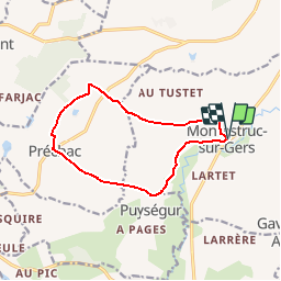
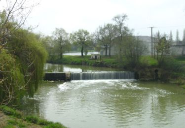
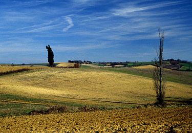
Trail Walking of 12 km to be discovered at Occitania, Gers, Montestruc-sur-Gers. This trail is proposed by tracegps.

Description

Un peu plus près des étoiles – Montestruc sur Gers Départ devant la Poste. A voir le village de Préchac… Circuit numérisé par la Communauté de Communes de la Lomagne Gersoise.

Elevation profile

Photos

Positioning

Country:
France
Region :
Occitania
Department/Province :
Gers
Municipality :
Montestruc-sur-Gers
Location:
Unknown
Start:(Dec)
Start:(UTM)
309336 ; 4851664 (31T) N.

Trails nearby

Trail Walking Sainte-Christie - Duo rando château Larroque - Photo
Walking
papounet32

Walking

Difficult
Sainte-Christie, Occitania, Gers, France
10 km | 12.3 km-effort
2h 41min
Yes
Trail Mountain bike Préchac - boucle  Préchac-Rejaumont 32 - Photo
Mountain bike
ludcobike

Mountain bike

Very easy
Préchac, Occitania, Gers, France
24 km | 29 km-effort
2h 20min
Yes
Trail Walking Montestruc-sur-Gers - Randonnée à travers champs - Montestruc - Photo
Walking
tracegps

Walking

Medium
Montestruc-sur-Gers, Occitania, Gers, France
16.7 km | 19.7 km-effort
4h 0min
Yes
Trail Walking Montestruc-sur-Gers - Le petit tour - Montestruc sur Gers - Photo
Walking
tracegps

Walking

Medium
Montestruc-sur-Gers, Occitania, Gers, France
5.9 km | 7.5 km-effort
3h 0min
Yes
Trail Walking Fleurance - Quand on marchait 8,5 km sur les chemins... - Fleurance - Photo
Walking
tracegps

Walking

Medium
Fleurance, Occitania, Gers, France
8.6 km | 10.2 km-effort
2h 10min
Yes
Trail Walking Fleurance - Quand on marchait 6 km sur les chemins... - Fleurance - Photo
Walking
tracegps

Walking

Easy
Fleurance, Occitania, Gers, France
6.6 km | 7.8 km-effort
1h 30min
Yes
Trail Walking Fleurance - Quand on marchait 4 km sur les chemins... - Fleurance - Photo
Walking
tracegps

Walking

Easy
Fleurance, Occitania, Gers, France
4.4 km | 5.2 km-effort
1h 0min
Yes
Trail Mountain bike Fleurance - Espace VTT FFC Vallons du Lectourois - Fleurance - Circuit n°19 - Photo
Mountain bike
tracegps

Mountain bike

Very difficult
Fleurance, Occitania, Gers, France
42 km | 51 km-effort
3h 30min
Yes
Trail Mountain bike Fleurance - Espace VTT FFC Vallons du Lectourois - Fleurance - Circuit n°18 - Photo
Mountain bike
tracegps

Mountain bike

Medium
Fleurance, Occitania, Gers, France
14.9 km | 18.2 km-effort
1h 15min
Yes


Close
My subscriptions