Trail Walking Lectoure - Navère - Lectoure - Photo

Navère - Lectoure

 tracegps
tracegps

User

© OpenStreetMap contributors
Length
Length
11.3 km
Max alt
Max alt
216 m
Uphill gradient
Uphill gradient
270 m
Km-Effort
Km-Effort  
14.9 km
Min alt
Min alt
85 m
Downhill gradient
Downhill gradient
267 m
Boucle
Boucle
Yes
Creation date :
2014-12-10 00:00:00.0
Updated on :
2014-12-10 00:00:00.0

(0 Reviews)

Walking
Walking
3h00
Difficulty : Medium

Scan this QR Code to open this trail in the SityTrail application

FREE GPS app for hiking

Logo SityTrail SityTrail

IGN / Geographical institutes

Download SityTrail from the App Store Download SityTrail from Google Play

Logo SityTrail SityTrail World

The world is yours!

Download SityTrail from the App Store Download SityTrail from Google Play Download SityTrail on Huawei AppGallery

About

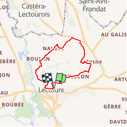
Trail Walking of 11.3 km to be discovered at Occitania, Gers, Lectoure. This trail is proposed by tracegps.

Description

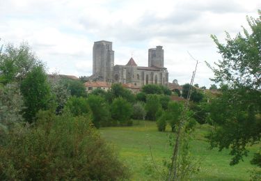
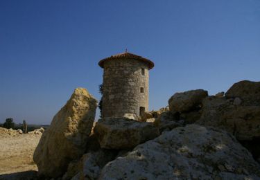
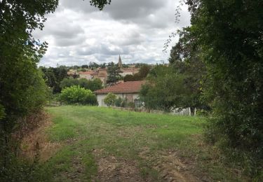
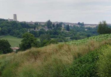
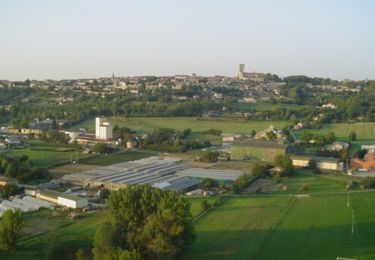
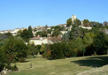
Navère – Lectoure Sorties sportives ou excursions en famille, la Lomagne vous permettra d’assouvir toutes vos envies de nature et de liberté grâce à un choix très large de circuits balisés ou de randonnées à thème et accompagnées. Avec des dénivelés, des distances et des difficultés plus ou moins importants, les 21 circuits pédestres, répartis sur le territoire de la Communauté de Communes de la Lomagne Gersoise, feront le bonheur de tous les randonneurs. Venez vous promener dans un décor chaleureux où les collines parsemées de blés et de tournesols laissent entrevoir des vallons couverts de vignes ou de vergers. La Lomagne est traversée par le GR de Pays "Coeur de Gascogne" qui fait une boucle de 165 km au départ d’Auch. Cet itinéraire peut s’accomplir en 6 jours. Départ de la Tour du Bourreau. Vue sur la cité et son architecture de défense… Circuit numérisé par la Communauté de Communes de la Lomagne Gersoise.

Elevation profile

Photos

Positioning

Country:
France
Region :
Occitania
Department/Province :
Gers
Municipality :
Lectoure
Location:
Unknown
Start:(Dec)
Start:(UTM)
309325 ; 4867481 (31T) N.

Trails nearby

Trail Walking Lectoure - GR65 Lectoure > La Romieu - Photo
Walking
choubaka77

Walking

Easy
Lectoure, Occitania, Gers, France
18.8 km | 24 km-effort
5h 53min
No
Trail Walking Lectoure - CC_Velay_ED_20_Lectoure_Castelnau-Auvignon_20080820 - Photo
Walking
patrickdanilo

Walking

Medium
Lectoure, Occitania, Gers, France
24 km | 30 km-effort
5h 45min
No
Trail Walking Lectoure - Lectoure - La Romieu - Chemin de Compostelle - Photo
Walking
tracegps

Walking

Very difficult
Lectoure, Occitania, Gers, France
19.6 km | 24 km-effort
7h 10min
No
Trail Walking Lectoure - 32-05-Au Cœur de Gascogne Auch-24km-102-5607- - Photo
Walking
rvs147

Walking

Medium
Lectoure, Occitania, Gers, France
24 km | 29 km-effort
6h 10min
No
Trail Walking Lectoure - espazot condom 13.7.2017  - Photo
Walking
mota.filipe

Walking

Very easy
Lectoure, Occitania, Gers, France
22 km | 27 km-effort
4h 50min
No
Trail Walking Lectoure - Lac des trois vallées - Lectoure - Photo
Walking
tracegps

Walking

Medium
(1)
Lectoure, Occitania, Gers, France
14.2 km | 18.3 km-effort
3h 30min
Yes
Trail Walking Lectoure - Groussan - Lectoure - Photo
Walking
tracegps

Walking

Medium
Lectoure, Occitania, Gers, France
4 km | 5.8 km-effort
1h 0min
Yes
Trail Walking Lectoure - Arton - Lectoure - Photo
Walking
tracegps

Walking

Difficult
Lectoure, Occitania, Gers, France
20 km | 25 km-effort
5h 0min
Yes
Trail Walking Lectoure - Les Galis - Lectoure - Photo
Walking
tracegps

Walking

Difficult
Lectoure, Occitania, Gers, France
17.9 km | 23 km-effort
4h 30min
Yes


Close
My subscriptions