Trail Walking Estreux - Balade à Estreux  - Photo

Balade à Estreux

 tracegps
tracegps

User

© OpenStreetMap contributors
Length
Length
8.4 km
Max alt
Max alt
99 m
Uphill gradient
Uphill gradient
68 m
Km-Effort
Km-Effort  
9.4 km
Min alt
Min alt
63 m
Downhill gradient
Downhill gradient
68 m
Boucle
Boucle
Yes
Creation date :
2014-12-11 00:00:00.0
Updated on :
2014-12-11 00:00:00.0

(1 Reviews)

Walking
Walking
2h10
Difficulty : Medium

Scan this QR Code to open this trail in the SityTrail application

FREE GPS app for hiking

Logo SityTrail SityTrail

IGN / Geographical institutes

Download SityTrail from the App Store Download SityTrail from Google Play

Logo SityTrail SityTrail World

The world is yours!

Download SityTrail from the App Store Download SityTrail from Google Play Download SityTrail on Huawei AppGallery

About

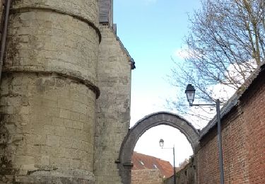
Trail Walking of 8.4 km to be discovered at Hauts-de-France, Nord, Estreux. This trail is proposed by tracegps.

Description

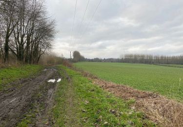
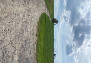
Circuit proposé par le comité départemental du Nord. Fiche n° 20 de la pochette « Ballades en Nord, morceaux choisis». Départ de la place d’Estreux. A la sortie de la ville, cette promenade emprunte beaucoup de chemins agricoles et pavés et emmène le randonneur à travers une campagne rurale, loin du bruit citadin, lui offrant une petite bouffée d’oxygène. De bonnes chaussures sont nécessaires par temps de pluie. Prudence le long des RD 50 et 250 Retrouvez cette randonnée sur le site du Comité Départemental du Tourisme du Nord.

Elevation profile

Photos

Positioning

Country:
France
Region :
Hauts-de-France
Department/Province :
Nord
Municipality :
Estreux
Location:
Unknown
Start:(UTM)
542215 ; 5577662 (31U) N.

Comments

Please log in to post a review or rate the element


belle balade


Trails nearby

Trail Walking Jenlain - Au départ de Jenlain - Photo
Walking
tracegps

Walking

Medium
(1)
Jenlain, Hauts-de-France, Nord, France
8.4 km | 9.7 km-effort
2h 10min
Yes
Trail Walking Jenlain - Jenlain 20,4 km - Photo
Walking
GUIDE
rvapeldo

Walking

Medium
Jenlain, Hauts-de-France, Nord, France
21 km | 24 km-effort
4h 54min
Yes
Trail Quad Sebourg - Sebourg - Photo
Quad
FRDFC

Quad

Very easy
(1)
Sebourg, Hauts-de-France, Nord, France
120 km | 133 km-effort
Unknown
Yes
Trail Walking Sebourg - Le Bois de Sebourg - Photo
Walking
corsinou

Walking

Very easy
(1)
Sebourg, Hauts-de-France, Nord, France
6.6 km | 7.7 km-effort
1h 41min
Yes
Trail Walking Wargnies-le-Grand - Jeanlain 15,3 km - Photo
Walking
GUIDE
rvapeldo

Walking

Easy
Wargnies-le-Grand, Hauts-de-France, Nord, France
15.2 km | 17.6 km-effort
4h 12min
Yes
Trail Walking Sebourg - Sebourg 17 km - Photo
Walking
GUIDE
rvapeldo

Walking

Medium
Sebourg, Hauts-de-France, Nord, France
17 km | 19.8 km-effort
4h 37min
Yes
Trail Walking Curgies - curgies, circuit des blockhaus - Photo
Walking
papiou

Walking

Difficult
Curgies, Hauts-de-France, Nord, France
11.6 km | 13 km-effort
2h 45min
Yes
Trail Walking Sebourg - 2019-07-07 Sebourg 10 km - Photo
Walking
dujcricri

Walking

Very easy
Sebourg, Hauts-de-France, Nord, France
9.6 km | 10.6 km-effort
Unknown
Yes
Trail Walking Sebourg - All around Sebourg - Photo
Walking
corsinou

Walking

Very easy
Sebourg, Hauts-de-France, Nord, France
10.9 km | 12.5 km-effort
2h 21min
Yes


Close
My subscriptions