Trail Walking Boulaur - Un tour à Boulaur par Saramon - Photo

Un tour à Boulaur par Saramon

 tracegps
tracegps

User

© OpenStreetMap contributors
Length
Length
14.9 km
Max alt
Max alt
284 m
Uphill gradient
Uphill gradient
251 m
Km-Effort
Km-Effort  
18.3 km
Min alt
Min alt
168 m
Downhill gradient
Downhill gradient
252 m
Boucle
Boucle
Yes
Creation date :
2014-12-10 00:00:00.0
Updated on :
2014-12-10 00:00:00.0

(2 Reviews)

Walking
Walking
5h10
Difficulty : Medium

Scan this QR Code to open this trail in the SityTrail application

FREE GPS app for hiking

Logo SityTrail SityTrail

IGN / Geographical institutes

Download SityTrail from the App Store Download SityTrail from Google Play

Logo SityTrail SityTrail World

The world is yours!

Download SityTrail from the App Store Download SityTrail from Google Play Download SityTrail on Huawei AppGallery

About

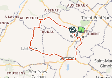
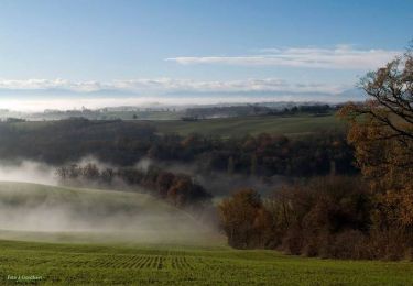
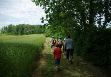
Trail Walking of 14.9 km to be discovered at Occitania, Gers, Boulaur. This trail is proposed by tracegps.

Description

Une balade en boucle autour de Boulaur en partant de l'Abbaye et en passant par Saramon dans le Gers.

Elevation profile

Photos

Positioning

Country:
France
Region :
Occitania
Department/Province :
Gers
Municipality :
Boulaur
Location:
Unknown
Start:(UTM)
320196 ; 4823292 (31T) N.

Comments

Please log in to post a review or rate the element


Des jolies points de vue, mais que du goudron et pas d'ombre.


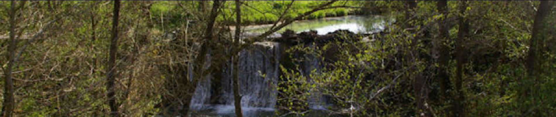
Très sympa, avec de superbes paysages sur la campagne gersoise et des vues sur nos magnifiques Pyrénées


Trails nearby

Trail Cycle Saramon - Circuit de 40 Km-  Saramon - Photo
Cycle
tracegps

Cycle

Medium
Saramon, Occitania, Gers, France
40 km | 47 km-effort
2h 0min
Yes
Trail Cycle Saramon - Circuit de 48 Km-  Saramon - Photo
Cycle
tracegps

Cycle

Difficult
Saramon, Occitania, Gers, France
48 km | 57 km-effort
3h 0min
Yes
Trail Cycle Saramon - Circuit découverte 2 - Saramon - Photo
Cycle
tracegps

Cycle

Difficult
Saramon, Occitania, Gers, France
50 km | 61 km-effort
3h 0min
Yes
Trail Cycle Saramon - Circuit découverte 1 - Saramon - Photo
Cycle
tracegps

Cycle

Easy
Saramon, Occitania, Gers, France
29 km | 35 km-effort
1h 40min
Yes
Trail Cycle Saramon - Circuit découverte 3 - Saramon - Photo
Cycle
tracegps

Cycle

Easy
Saramon, Occitania, Gers, France
28 km | 35 km-effort
1h 40min
Yes
Trail Cycle Saramon - Circuit de 44 Km-  Saramon - Photo
Cycle
tracegps

Cycle

Medium
Saramon, Occitania, Gers, France
44 km | 54 km-effort
2h 30min
Yes
Trail Walking Aurimont - 2020-05-17_21h44m57_le-chemin-d-en-jannet-carreau-aurimont - Photo
Walking
jeromelacoste

Walking

Medium
Aurimont, Occitania, Gers, France
9.2 km | 11 km-effort
2h 24min
Yes
Trail Walking Castelnau-Barbarens - castelnau - Barbarens - Photo
Walking
christian19

Walking

Easy
Castelnau-Barbarens, Occitania, Gers, France
10.6 km | 13.5 km-effort
2h 34min
Yes
Trail Walking Saramon - saramon boulor lartigue - Photo
Walking
phb32220

Walking

Very easy
Saramon, Occitania, Gers, France
15 km | 18.4 km-effort
2h 21min
Yes


Close
My subscriptions