Trail Mountain bike Villefranche-du-Queyran - Villefranche, la bastide du Queyran - Pays Val de Garonne - Gascogne - Photo

Villefranche, la bastide du Queyran - Pays Val de Garonne - Gascogne

 tracegps
tracegps

User

© OpenStreetMap contributors
Length
Length
15.1 km
Max alt
Max alt
179 m
Uphill gradient
Uphill gradient
229 m
Km-Effort
Km-Effort  
18.2 km
Min alt
Min alt
66 m
Downhill gradient
Downhill gradient
229 m
Boucle
Boucle
Yes
Creation date :
2014-12-10 00:00:00.0
Updated on :
2014-12-10 00:00:00.0

(0 Reviews)

Mountain bike
Mountain bike
1h55
Difficulty : Difficult

Scan this QR Code to open this trail in the SityTrail application

FREE GPS app for hiking

Logo SityTrail SityTrail

IGN / Geographical institutes

Download SityTrail from the App Store Download SityTrail from Google Play

Logo SityTrail SityTrail World

The world is yours!

Download SityTrail from the App Store Download SityTrail from Google Play Download SityTrail on Huawei AppGallery

About

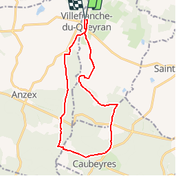
Trail Mountain bike of 15.1 km to be discovered at New Aquitaine, Lot-et-Garonne, Villefranche-du-Queyran. This trail is proposed by tracegps.

Description

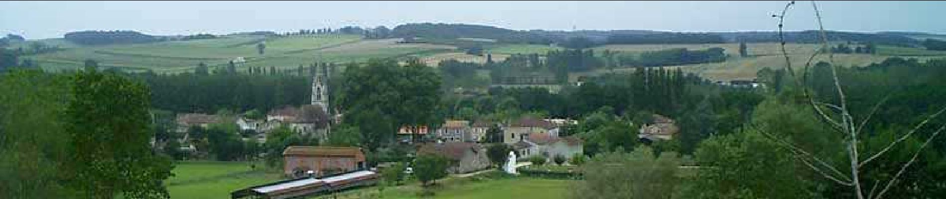
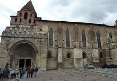
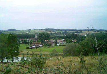
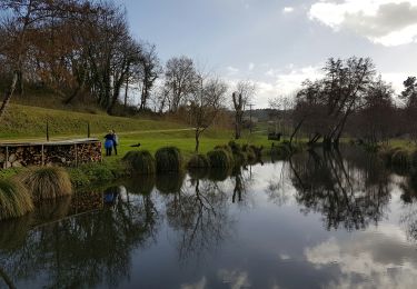
Villefranche-du-Queyran -Cté de Communes Val de Garonne. Cette ville nouvelle, fondée au 13eme siècle par Édouard 1er d’Angleterre, porte le nom d’un petit territoire. Le Queyran s’étend sur des terroirs complémentaires à la frontière de la vallée de la Garonne et de la forêt. Téléchargez la fiche de cette randonnée sur le site du Tourisme du Lot et Garonne.

Elevation profile

Photos

Positioning

Country:
France
Region :
New Aquitaine
Department/Province :
Lot-et-Garonne
Municipality :
Villefranche-du-Queyran
Location:
Unknown
Start:(UTM)
276438 ; 4910090 (31T) N.

Trails nearby

Trail On foot Puch-d'Agenais - Puch-d’Agenais, dans les terrasses de Garonne - 6.2km - Photo
On foot
PRO

On foot

Easy
Puch-d'Agenais, New Aquitaine, Lot-et-Garonne, France
6.1 km | 7 km-effort
1h 35min
Yes
Trail On foot Villefranche-du-Queyran - Villefranche, la bastide du Queyran - 15.2 km - Photo
On foot
PRO

On foot

Easy
Villefranche-du-Queyran, New Aquitaine, Lot-et-Garonne, France
15 km | 18 km-effort
4h 5min
Yes
Trail Cycle Anzex - Canal Garonne de casteljaloux à Castelssarasin - Photo
Cycle
destras

Cycle

Easy
Anzex, New Aquitaine, Lot-et-Garonne, France
116 km | 127 km-effort
7h 14min
No
Trail On foot Anzex - Anzex, la promenade de Pèleperdrix (7,9 km, balisage jaune) - Photo
On foot
PRO

On foot

Easy
Anzex, New Aquitaine, Lot-et-Garonne, France
7.6 km | 9.4 km-effort
2h 8min
No
Trail Mountain bike Puch-d'Agenais - Puch-d'Agenais, dans les terrasses de Garonne - Pays de la vallée du Lot  - Photo
Mountain bike
tracegps

Mountain bike

Easy
Puch-d'Agenais, New Aquitaine, Lot-et-Garonne, France
6.1 km | 7 km-effort
30min
Yes
Trail Walking Puch-d'Agenais - Puch-d'Agenais, dans les terrasses de Garonne - Pays de la vallée du Lot  - Photo
Walking
tracegps

Walking

Easy
Puch-d'Agenais, New Aquitaine, Lot-et-Garonne, France
6.1 km | 7 km-effort
2h 0min
Yes
Trail Walking Villefranche-du-Queyran - Villefranche, la bastide du Queyran - Pays Val de Garonne - Gascogne - Photo
Walking
tracegps

Walking

Difficult
Villefranche-du-Queyran, New Aquitaine, Lot-et-Garonne, France
15.1 km | 18.2 km-effort
4h 0min
Yes
Trail Walking Villefranche-du-Queyran - Villefranche du queran - Photo
Walking
christiane01

Walking

Medium
Villefranche-du-Queyran, New Aquitaine, Lot-et-Garonne, France
6.7 km | 7.7 km-effort
1h 58min
Yes
Trail Walking Villefranche-du-Queyran - villefranche9km - Photo
Walking
garigotte

Walking

Very easy
Villefranche-du-Queyran, New Aquitaine, Lot-et-Garonne, France
9.2 km | 10.8 km-effort
2h 11min
Yes


Close
My subscriptions