Trail Walking Puimichel - Randonnée à Puimichel - Photo
 tracegps
tracegps

User

© OpenStreetMap contributors
Length
Length
8.6 km
Max alt
Max alt
748 m
Uphill gradient
Uphill gradient
303 m
Km-Effort
Km-Effort  
12.7 km
Min alt
Min alt
578 m
Downhill gradient
Downhill gradient
302 m
Boucle
Boucle
Yes
Creation date :
2014-12-10 00:00:00.0
Updated on :
2014-12-10 00:00:00.0

(3 Reviews)

Walking
Walking
3h00
Difficulty : Easy

Scan this QR Code to open this trail in the SityTrail application

FREE GPS app for hiking

Logo SityTrail SityTrail

IGN / Geographical institutes

Download SityTrail from the App Store Download SityTrail from Google Play

Logo SityTrail SityTrail World

The world is yours!

Download SityTrail from the App Store Download SityTrail from Google Play Download SityTrail on Huawei AppGallery

About

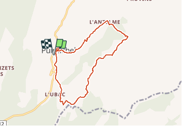
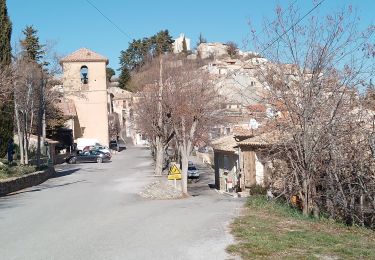
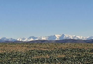
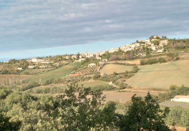
Trail Walking of 8.6 km to be discovered at Provence-Alpes-Côte d'Azur, Alpes-de-Haute-Provence, Puimichel. This trail is proposed by tracegps.

Description

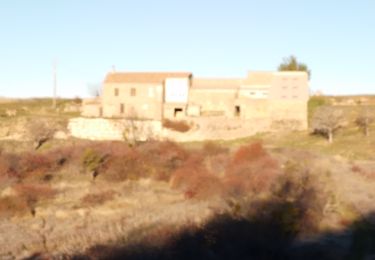
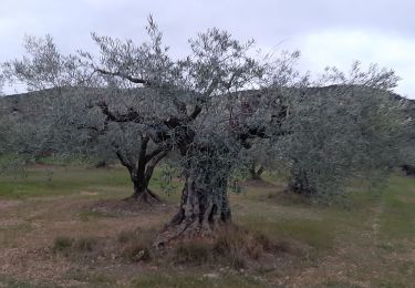
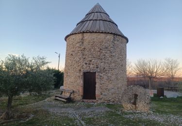
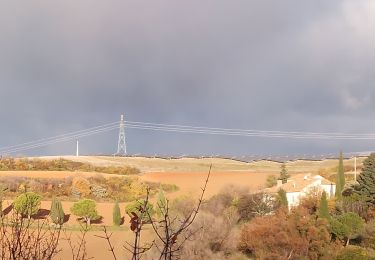
Départ au pied du moulin (pique-nique possible sur une aire dédiée), montée vers la chapelle qui domine la commune, redescente au village pour une large boucle champêtre avec de beaux paysages.

Elevation profile

Photos

Points of interest

Point of interest Puimichel - Moulin - Photo
tracegps
PUIMICHEL 

Positioning

Country:
France
Region :
Provence-Alpes-Côte d'Azur
Department/Province :
Alpes-de-Haute-Provence
Municipality :
Puimichel
Location:
Unknown
Start:(UTM)
260900 ; 4873164 (32T) N.

Comments

Please log in to post a review or rate the element


très jolie randonnee bravo le chemin est visible tout le long du parcours sur le site de sity merci a l auteur de la rando Jean marc canu


au nord de charasse, le sentier n'est plus visible


Trails nearby

Trail Walking Les Mées - les mees . oratoire Saint Antoine.  - Photo
Walking
Roger

Walking

Easy
Les Mées, Provence-Alpes-Côte d'Azur, Alpes-de-Haute-Provence, France
8 km | 10 km-effort
2h 32min
Yes
Trail Walking Puimichel - puimichel.  les vilards.  - Photo
Walking
Roger

Walking

Medium
Puimichel, Provence-Alpes-Côte d'Azur, Alpes-de-Haute-Provence, France
11.1 km | 15 km-effort
3h 28min
Yes
Trail Walking Puimichel - Le castellet. puimichel  - Photo
Walking
Roger

Walking

Medium
Puimichel, Provence-Alpes-Côte d'Azur, Alpes-de-Haute-Provence, France
10.4 km | 14.2 km-effort
3h 24min
Yes
Trail On foot Les Mées - Le chemin de la Colle - Photo
On foot
PRO

On foot

Easy
Les Mées, Provence-Alpes-Côte d'Azur, Alpes-de-Haute-Provence, France
6.1 km | 7.1 km-effort
1h 36min
No
Trail Walking Le Castellet - ENTREVENNES . TOUR DU COLOMBIER n - Photo
Walking
RobinMicheline

Walking

Medium
Le Castellet, Provence-Alpes-Côte d'Azur, Alpes-de-Haute-Provence, France
18.7 km | 23 km-effort
4h 19min
Yes
Trail Walking Les Mées - LES MEES .Chapelle St Pierre , la Bressanne , la Bessonne o l s - Photo
Walking
RobinMicheline

Walking

Easy
Les Mées, Provence-Alpes-Côte d'Azur, Alpes-de-Haute-Provence, France
14.8 km | 19.8 km-effort
3h 23min
Yes
Trail Walking Puimichel - PUIMICHEL.  AUTOUR DE PUIMICHEL . O . L - Photo
Walking
RobinMicheline

Walking

Medium
Puimichel, Provence-Alpes-Côte d'Azur, Alpes-de-Haute-Provence, France
9.1 km | 13.1 km-effort
2h 19min
Yes
Trail Walking Les Mées - les mees.  oratoire Saint Antoine  - Photo
Walking
Roger

Walking

Easy
Les Mées, Provence-Alpes-Côte d'Azur, Alpes-de-Haute-Provence, France
7.6 km | 10 km-effort
2h 37min
Yes
Trail Walking Puimichel - puimichel. les antelmes - Photo
Walking
Roger

Walking

Easy
Puimichel, Provence-Alpes-Côte d'Azur, Alpes-de-Haute-Provence, France
6.9 km | 9.7 km-effort
2h 15min
Yes


Close
My subscriptions