Trail Walking Villeneuve-d'Allier - Villeneuve d'Allier - Photo
 tracegps
tracegps

User

© OpenStreetMap contributors
Length
Length
14.2 km
Max alt
Max alt
661 m
Uphill gradient
Uphill gradient
444 m
Km-Effort
Km-Effort  
20 km
Min alt
Min alt
449 m
Downhill gradient
Downhill gradient
443 m
Boucle
Boucle
Yes
Creation date :
2014-12-10 00:00:00.0
Updated on :
2014-12-10 00:00:00.0

(0 Reviews)

Walking
Walking
4h00
Difficulty : Medium

Scan this QR Code to open this trail in the SityTrail application

FREE GPS app for hiking

Logo SityTrail SityTrail

IGN / Geographical institutes

Download SityTrail from the App Store Download SityTrail from Google Play

Logo SityTrail SityTrail World

The world is yours!

Download SityTrail from the App Store Download SityTrail from Google Play Download SityTrail on Huawei AppGallery

About

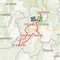
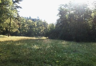
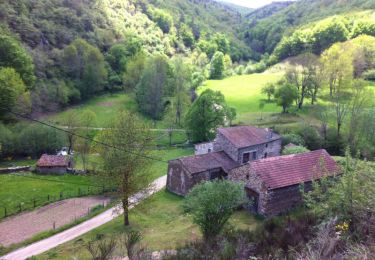
Trail Walking of 14.2 km to be discovered at Auvergne-Rhône-Alpes, Haute-Loire, Villeneuve-d'Allier. This trail is proposed by tracegps.

Description

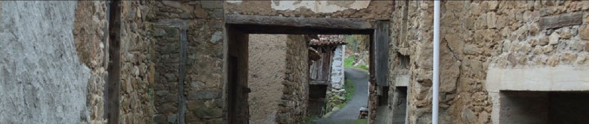
Départ dans le village de Villeneuve d'Allier au parking à gauche de la route, juste en face de la route de Rougeac. L'itinéraire boisé de feuillus et découvert dans sa partie Ouest, suit grosso-modo une ligne de niveau surplombant la vallée de l'Allier et de son affluent "le ruisseau d'Arçon". A Condros, la ruelle empruntée est bordée de maions en pisé qui semblent issues du Moyen-âge. Le parcours sans difficulté offre de très nombreux points de vue sur le village de Saint-Ilpize.

Elevation profile

Photos

Points of interest

Point of interest Villeneuve-d'Allier - départ - Photo
tracegps
VILLENEUVE-D'ALLIER 

Positioning

Country:
France
Region :
Auvergne-Rhône-Alpes
Department/Province :
Haute-Loire
Municipality :
Villeneuve-d'Allier
Location:
Unknown
Start:(UTM)
530134 ; 5004943 (31T) N.

Trails nearby

Trail Motor Villeneuve-d'Allier - enduro  - Photo
Motor
MikaDeli

Motor

Very easy
(1)
Villeneuve-d'Allier, Auvergne-Rhône-Alpes, Haute-Loire, France
147 km | 212 km-effort
7h 0min
Yes
Trail Walking Villeneuve-d'Allier - 2019-03-28 16:49:26 - Photo
Walking
GilGry

Walking

Very difficult
Villeneuve-d'Allier, Auvergne-Rhône-Alpes, Haute-Loire, France
26 km | 36 km-effort
7h 36min
Yes
Trail Mountain bike Chilhac - vtt chilhac - langeac - Photo
Mountain bike
malaki

Mountain bike

Medium
Chilhac, Auvergne-Rhône-Alpes, Haute-Loire, France
29 km | 38 km-effort
3h 9min
Yes
Trail Mountain bike Saint-Privat-du-Dragon - chilhac - lavaudieu - Photo
Mountain bike
malaki

Mountain bike

Medium
Saint-Privat-du-Dragon, Auvergne-Rhône-Alpes, Haute-Loire, France
46 km | 60 km-effort
3h 56min
No
Trail Walking Saint-Just-près-Brioude - Le volcan de la Vergueur - St Just près Brioude - Photo
Walking
tracegps

Walking

Difficult
Saint-Just-près-Brioude, Auvergne-Rhône-Alpes, Haute-Loire, France
19.4 km | 28 km-effort
5h 0min
Yes
Trail Walking Chilhac - Le plateau d'Ally - Photo
Walking
tracegps

Walking

Difficult
Chilhac, Auvergne-Rhône-Alpes, Haute-Loire, France
23 km | 33 km-effort
6h 0min
No
Trail Horseback riding Saint-Ilpize - Caracolade J6 St Ilpize Lavoute Chilhac fait  - Photo
Horseback riding
Flocharlot

Horseback riding

Very easy
Saint-Ilpize, Auvergne-Rhône-Alpes, Haute-Loire, France
21 km | 29 km-effort
5h 20min
No
Trail Walking Villeneuve-d'Allier - GORGES DE L ALLIER 2 - Photo
Walking
LOICFOUCRIT

Walking

Very difficult
Villeneuve-d'Allier, Auvergne-Rhône-Alpes, Haute-Loire, France
14.7 km | 22 km-effort
5h 3min
No
Trail Walking Chilhac - Chilhac -Falaises du Blot -Chilhac - Photo
Walking
phcol

Walking

Medium
Chilhac, Auvergne-Rhône-Alpes, Haute-Loire, France
8.7 km | 11.7 km-effort
2h 29min
Yes


Close
My subscriptions