Trail Mountain bike Pont-l'Évêque - Randonnée VTT Pont l'Eveque du 08/05/2010 25 Km - Photo

Randonnée VTT Pont l'Eveque du 08/05/2010 25 Km

 tracegps
tracegps

User

© OpenStreetMap contributors
Length
Length
23 km
Max alt
Max alt
127 m
Uphill gradient
Uphill gradient
401 m
Km-Effort
Km-Effort  
28 km
Min alt
Min alt
9 m
Downhill gradient
Downhill gradient
401 m
Boucle
Boucle
Yes
Creation date :
2014-12-10 00:00:00.0
Updated on :
2014-12-10 00:00:00.0

(0 Reviews)

Mountain bike
Mountain bike
2h00
Difficulty : Difficult

Scan this QR Code to open this trail in the SityTrail application

FREE GPS app for hiking

Logo SityTrail SityTrail

IGN / Geographical institutes

Download SityTrail from the App Store Download SityTrail from Google Play

Logo SityTrail SityTrail World

The world is yours!

Download SityTrail from the App Store Download SityTrail from Google Play Download SityTrail on Huawei AppGallery

About

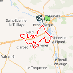
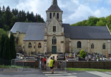
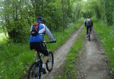
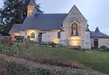
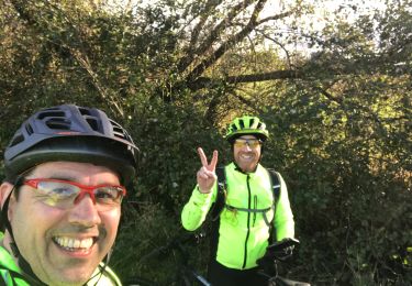
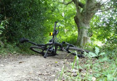
Trail Mountain bike of 23 km to be discovered at Normandy, Calvados, Pont-l'Évêque. This trail is proposed by tracegps.

Description

Départ de Pont l'Évêque place du cinéma pour un bout de route en direction de CAEN, passage par la commune de Reux, de Clarbec, St Hymer. de belles descentes à près de 60 Km/H. Très beaux chemins entre St Hymer et le lac de Pont l'Évêque, un dénivelée positif et négatif (Boucle) d'environ 450 Mètres. retour par le lac de pont l'Évêque, beaucoup de plaisir et des passages techniques.

Elevation profile

Positioning

Country:
France
Region :
Normandy
Department/Province :
Calvados
Municipality :
Pont-l'Évêque
Location:
Pont-l'Évêque
Start:(UTM)
295296 ; 5463060 (31U) N.

Trails nearby

Trail Walking Pont-l'Évêque - Lac de Pont l'Évêque  - Photo
Walking
tracegps

Walking

Difficult
(3)
Pont-l'Évêque, Normandy, Calvados, France
14.8 km | 18.9 km-effort
4h 10min
Yes
Trail Walking Reux - La croix de fer - Photo
Walking
neoroll44

Walking

Easy
(2)
Reux, Normandy, Calvados, France
5.7 km | 6.2 km-effort
1h 30min
No
Trail Walking Saint-Hymer - St Hymer - Photo
Walking
Eve - Line

Walking

Medium
Saint-Hymer, Normandy, Calvados, France
12.6 km | 15.3 km-effort
2h 49min
Yes
Trail Walking Pierrefitte-en-Auge - Pierrefitte-en-Auge - Photo
Walking
gr1346

Walking

Medium
(1)
Pierrefitte-en-Auge, Normandy, Calvados, France
15 km | 18.6 km-effort
4h 3min
Yes
Trail Mountain bike Pont-l'Évêque - Rando Pont l'Evèque - Photo
Mountain bike
tracegps

Mountain bike

Difficult
Pont-l'Évêque, Normandy, Calvados, France
32 km | 39 km-effort
2h 30min
Yes
Trail Walking Pont-l'Évêque - Rando Pont l'Evèque - Photo
Walking
tracegps

Walking

Difficult
Pont-l'Évêque, Normandy, Calvados, France
32 km | 39 km-effort
6h 0min
Yes
Trail Walking Vieux-Bourg - Vieux Bourg - Photo
Walking
Eve - Line

Walking

Medium
(1)
Vieux-Bourg, Normandy, Calvados, France
12.3 km | 15.8 km-effort
3h 10min
Yes
Trail Mountain bike Pont-l'Évêque - 32 km VTT avec Denys  - Photo
Mountain bike
Marc Girard

Mountain bike

Pont-l'Évêque, Normandy, Calvados, France
32 km | 38 km-effort
2h 55min
No
Trail Mountain bike Saint-Hymer - De Saint - Hymer à Clarbec - Photo
Mountain bike
tracegps

Mountain bike

Difficult
Saint-Hymer, Normandy, Calvados, France
34 km | 41 km-effort
2h 30min
Yes


Close
My subscriptions