Trail Mountain bike Vesc - La Lance par Col de Vesc - Photo

La Lance par Col de Vesc

 tracegps
tracegps

User

© OpenStreetMap contributors
Length
Length
38 km
Max alt
Max alt
984 m
Uphill gradient
Uphill gradient
1617 m
Km-Effort
Km-Effort  
60 km
Min alt
Min alt
448 m
Downhill gradient
Downhill gradient
1617 m
Boucle
Boucle
Yes
Creation date :
2014-12-10 00:00:00.0
Updated on :
2014-12-10 00:00:00.0

(0 Reviews)

Mountain bike
Mountain bike
3h39
Difficulty : Difficult

Scan this QR Code to open this trail in the SityTrail application

FREE GPS app for hiking

Logo SityTrail SityTrail

IGN / Geographical institutes

Download SityTrail from the App Store Download SityTrail from Google Play

Logo SityTrail SityTrail World

The world is yours!

Download SityTrail from the App Store Download SityTrail from Google Play Download SityTrail on Huawei AppGallery

About

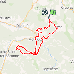
Trail Mountain bike of 38 km to be discovered at Auvergne-Rhône-Alpes, Drôme, Vesc. This trail is proposed by tracegps.

Description

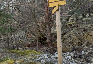
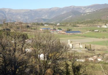
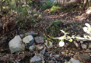
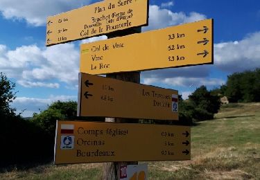
Rando au départ du col de Vesc, descente très très pentue après le col de Mazelle (prudence), montée sur la Lance jusqu'à la base d'envol (979M) et descente par un sentier pierreux mais accessible. Remontée par la route et le piste au col Imbert et descente par sentier jusqu'à Monjoux. Retour au col de Vesc. En garder sous la pédale, balade qui demande de l'entrainement ! A faire par beau temps pour les panoramas ! C'est une rando des Tontons Dérailleurs.

Elevation profile

Photos

Positioning

Country:
France
Region :
Auvergne-Rhône-Alpes
Department/Province :
Drôme
Municipality :
Vesc
Location:
Unknown
Start:(UTM)
669147 ; 4933441 (31T) N.

Trails nearby

Trail Walking Montjoux - Le Devès - Montjoux - Photo
Walking
tracegps

Walking

Easy
(1)
Montjoux, Auvergne-Rhône-Alpes, Drôme, France
5.3 km | 7 km-effort
1h 19min
Yes
Trail Walking Montjoux - 2022-12-16_08h52m12_tmpWriteApidae_48958_fr - Photo
Walking
chancha

Walking

Easy
Montjoux, Auvergne-Rhône-Alpes, Drôme, France
6.1 km | 8.4 km-effort
1h 55min
Yes
Trail sport Vesc - Wikiloc - Vesc - Photo
sport
johnw

sport

Very easy
(1)
Vesc, Auvergne-Rhône-Alpes, Drôme, France
8 km | 12.9 km-effort
Unknown
Yes
Trail Walking Vesc - bec de jus - Photo
Walking
Vero7684

Walking

Difficult
Vesc, Auvergne-Rhône-Alpes, Drôme, France
13.6 km | 25 km-effort
5h 51min
Yes
Trail Walking Vesc - bec de jus - Photo
Walking
parastat

Walking

Medium
Vesc, Auvergne-Rhône-Alpes, Drôme, France
5.1 km | 10.9 km-effort
2h 27min
Yes
Trail Walking Montjoux - Grottes Sarrazines - Photo
Walking
ajd26

Walking

Easy
Montjoux, Auvergne-Rhône-Alpes, Drôme, France
16.2 km | 25 km-effort
5h 5min
Yes
Trail Walking Vesc - VESC3 - Photo
Walking
GUIDE
thonyc

Walking

Difficult
Vesc, Auvergne-Rhône-Alpes, Drôme, France
17.5 km | 27 km-effort
5h 0min
Yes
Trail Walking Vesc - Hubac de Ruy - Photo
Walking
AIGUIER

Walking

Medium
(1)
Vesc, Auvergne-Rhône-Alpes, Drôme, France
13.9 km | 20 km-effort
5h 24min
Yes
Trail Walking Comps - Comps et col de la Pousterle - Photo
Walking
rcu3824

Walking

Easy
Comps, Auvergne-Rhône-Alpes, Drôme, France
9.8 km | 16.8 km-effort
3h 25min
Yes


Close
My subscriptions