Trail Walking Saint-Beauzély - Azinières, les dix Cazelles  - Photo

Azinières, les dix Cazelles

 tracegps
tracegps

User

© OpenStreetMap contributors
Length
Length
13.1 km
Max alt
Max alt
788 m
Uphill gradient
Uphill gradient
304 m
Km-Effort
Km-Effort  
17.2 km
Min alt
Min alt
676 m
Downhill gradient
Downhill gradient
303 m
Boucle
Boucle
Yes
Creation date :
2014-12-10 00:00:00.0
Updated on :
2014-12-10 00:00:00.0

(2 Reviews)

Walking
Walking
3h30
Difficulty : Medium

Scan this QR Code to open this trail in the SityTrail application

FREE GPS app for hiking

Logo SityTrail SityTrail

IGN / Geographical institutes

Download SityTrail from the App Store Download SityTrail from Google Play

Logo SityTrail SityTrail World

The world is yours!

Download SityTrail from the App Store Download SityTrail from Google Play Download SityTrail on Huawei AppGallery

About

Trail Walking of 13.1 km to be discovered at Occitania, Aveyron, Saint-Beauzély. This trail is proposed by tracegps.

Description

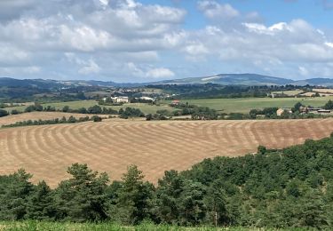
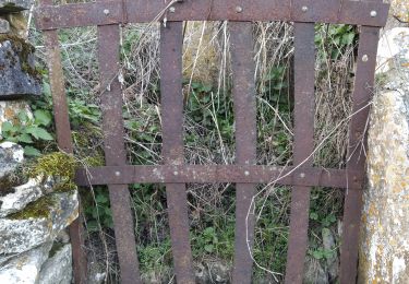
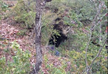
Départ du Village d'AZINIERES. Se diriger au sud jusqu'au Ravin des Vignals, regagner le plateau jusqu'au Puech de Loulhe et revenir par Le Vergnou. Sur le Causse, vous pourrez admirer le long de ce circuit 10 Cazelles typiques de la région et au retour un Dolmen, caché au milieu des buis.

Elevation profile

Photos

Positioning

Country:
France
Region :
Occitania
Department/Province :
Aveyron
Municipality :
Saint-Beauzély
Location:
Unknown
Start:(UTM)
499210 ; 4888563 (31T) N.

Comments

Please log in to post a review or rate the element


ballade écourtée barrière 3km avant la fin


très belles Chazelles


Trails nearby

Trail Walking Millau - Randonnée autour du Viaduc  de Millau - Photo
Walking
tracegps

Walking

Difficult
(2)
Millau, Occitania, Aveyron, France
18.5 km | 26 km-effort
5h 30min
Yes
Trail Walking Saint-Beauzély - Azinieres - Photo
Walking
Sandrine Micou

Walking

Medium
Saint-Beauzély, Occitania, Aveyron, France
17.4 km | 22 km-effort
4h 57min
Yes
Trail Running Saint-Beauzély - Trail de la Muse - Saint Beauzély - Photo
Running
tracegps

Running

Difficult
Saint-Beauzély, Occitania, Aveyron, France
24 km | 36 km-effort
3h 30min
Yes
Trail Walking Saint-Beauzély - Trail de la Muse - Saint Beauzély - Photo
Walking
tracegps

Walking

Difficult
Saint-Beauzély, Occitania, Aveyron, France
24 km | 36 km-effort
5h 30min
Yes
Trail Walking Saint-Beauzély - St beauz  cloître beaumette St b - Photo
Walking
lablaquiere

Walking

Difficult
(1)
Saint-Beauzély, Occitania, Aveyron, France
8.5 km | 12.5 km-effort
1h 46min
Yes
Trail Running Castelnau-Pégayrols - moulibez castelneau peg castelmus moulibez - Photo
Running
lablaquiere

Running

Very easy
Castelnau-Pégayrols, Occitania, Aveyron, France
10.6 km | 15.7 km-effort
2h 6min
Yes
Trail Walking Millau - Soulobres Therondels Peyre - Photo
Walking
at12

Walking

Very easy
Millau, Occitania, Aveyron, France
11.2 km | 17.6 km-effort
2h 50min
Yes
Trail Walking Millau - galettes chapelle de brocuejouls - Photo
Walking
colber

Walking

Very easy
Millau, Occitania, Aveyron, France
6.7 km | 8.6 km-effort
1h 52min
No
Trail Moto cross Millau - 2jours 2021 j1 - Photo
Moto cross
frank12

Moto cross

Very easy
Millau, Occitania, Aveyron, France
73 km | 93 km-effort
2h 0min
No


Close
My subscriptions