Trail Mountain bike Mazet-Saint-Voy - Espace VTT FFC Le Velay des 3 Rivières - N°34 Le Lizieux - Le-Mazet-St-Voy - Photo

Espace VTT FFC Le Velay des 3 Rivières - N°34 Le Lizieux - Le-Mazet-St-Voy

 tracegps
tracegps

User

© OpenStreetMap contributors
Length
Length
24 km
Max alt
Max alt
1306 m
Uphill gradient
Uphill gradient
605 m
Km-Effort
Km-Effort  
32 km
Min alt
Min alt
1001 m
Downhill gradient
Downhill gradient
603 m
Boucle
Boucle
Yes
Creation date :
2014-12-10 00:00:00.0
Updated on :
2014-12-10 00:00:00.0

(0 Reviews)

Mountain bike
Mountain bike
3h15
Difficulty : Difficult

Scan this QR Code to open this trail in the SityTrail application

FREE GPS app for hiking

Logo SityTrail SityTrail

IGN / Geographical institutes

Download SityTrail from the App Store Download SityTrail from Google Play

Logo SityTrail SityTrail World

The world is yours!

Download SityTrail from the App Store Download SityTrail from Google Play Download SityTrail on Huawei AppGallery

About

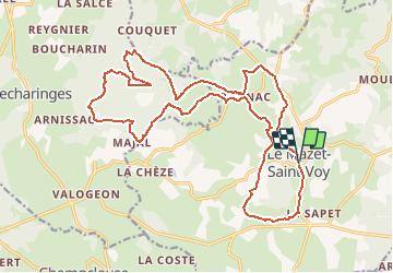
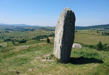
Trail Mountain bike of 24 km to be discovered at Auvergne-Rhône-Alpes, Haute-Loire, Mazet-Saint-Voy. This trail is proposed by tracegps.

Description

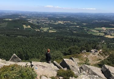
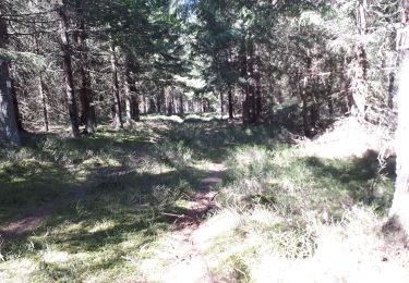
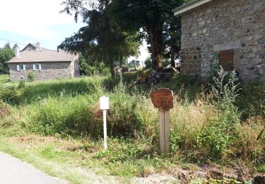
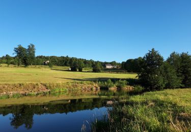
Espace VTT FFC Le Velay des 3 Rivières Circuit labellisé par la Fédération Française de Cyclisme. A plus de 1000 mètres d'altitude, dominé par le suc de Lizieux, ce circuit, cheminant entre prairies et bois, entre vallons et plateaux, vous mènera du village de Saint-Voy à la forêt du Lizieux. Le topo-guide Chamina est en vente dans le réseau Chamina, dans les Offices de Tourisme du territoire et auprès du Syndicat d’Initiative.

Elevation profile

Photos

Positioning

Country:
France
Region :
Auvergne-Rhône-Alpes
Department/Province :
Haute-Loire
Municipality :
Mazet-Saint-Voy
Location:
Unknown
Start:(UTM)
598037 ; 4988935 (31T) N.

Trails nearby

Trail Walking Araules - Suc de Lizieux - Photo
Walking
Galoche

Walking

Medium
Araules, Auvergne-Rhône-Alpes, Haute-Loire, France
4.6 km | 6.9 km-effort
1h 38min
Yes
Trail Walking Mazet-Saint-Voy - Volamont - Photo
Walking
mallovon

Walking

Easy
Mazet-Saint-Voy, Auvergne-Rhône-Alpes, Haute-Loire, France
5 km | 6.7 km-effort
2h 32min
Yes
Trail Walking Araules - le sentier de Bonas - Photo
Walking
michba

Walking

Easy
Araules, Auvergne-Rhône-Alpes, Haute-Loire, France
6.8 km | 9.5 km-effort
1h 57min
Yes
Trail Walking Les Vastres - Villelonge-Les Vastres PR - Photo
Walking
mallovon

Walking

Very easy
Les Vastres, Auvergne-Rhône-Alpes, Haute-Loire, France
14 km | 17 km-effort
3h 47min
No
Trail Walking Mazet-Saint-Voy - Baignade du moulin de Boyer - Photo
Walking
mallovon

Walking

Very easy
Mazet-Saint-Voy, Auvergne-Rhône-Alpes, Haute-Loire, France
3.7 km | 4.8 km-effort
1h 29min
Yes
Trail Walking Le Chambon-sur-Lignon - Tence-170623 - CreuxLoup-RetourVVF - Photo
Walking
randodan

Walking

Easy
Le Chambon-sur-Lignon, Auvergne-Rhône-Alpes, Haute-Loire, France
6.3 km | 8 km-effort
1h 40min
No
Trail Walking Araules - Tence-170620 - PicLisieux - Photo
Walking
randodan

Walking

Medium
Araules, Auvergne-Rhône-Alpes, Haute-Loire, France
5.2 km | 7.6 km-effort
1h 50min
Yes
Trail Walking Mazet-Saint-Voy - Salettes et Mazalibran - Photo
Walking
mallovon

Walking

Medium
Mazet-Saint-Voy, Auvergne-Rhône-Alpes, Haute-Loire, France
8.8 km | 11.9 km-effort
2h 30min
Yes
Trail Walking Le Chambon-sur-Lignon - variante circuit des pelerins - 7 km - Photo
Walking
famillerudent

Walking

Easy
Le Chambon-sur-Lignon, Auvergne-Rhône-Alpes, Haute-Loire, France
7.1 km | 9.4 km-effort
5h 41min
Yes


Close
My subscriptions