Aubignosc, Alpes-de-Haute-Provence: Best trails, routes and walks

1 comments

Aubignosc: Discover the best trails: 21 hiking trails and 1 bike and mountain-bike routes. All these trails, routes and outdoor activities are available in our SityTrail applications for smartphones and tablets.
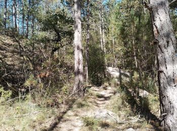
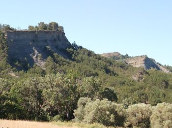
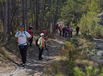
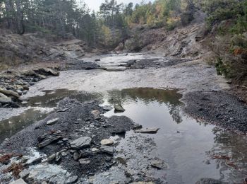

The best trails (23)

Trail Walking Aubignosc - aubignosc. les canyons. partie basse - Photo
Walking 7.915
Km

Walking

Medium
Aubignosc, Provence-Alpes-Côte d'Azur, Alpes-de-Haute-Provence, France
7.9 km | 11.1 km-effort
2h 50min
239 m
238 m
Yes
Roger

Trail Walking Aubignosc - aubignosc. Le canyon de mourieu  , partie haute  - Photo
Walking 4.91
Km

Walking

Medium
Aubignosc, Provence-Alpes-Côte d'Azur, Alpes-de-Haute-Provence, France
4.9 km | 6.7 km-effort
2h 20min
136 m
135 m
Yes
Roger

Trail Walking Aubignosc - AUBIGNOSC.  Vieil Chateau Neuf  , canyons o l m s - Photo
Walking 12.615
Km

Walking

Easy
(1)
Aubignosc, Provence-Alpes-Côte d'Azur, Alpes-de-Haute-Provence, France
12.6 km | 17.6 km-effort
3h 33min
370 m
379 m
Yes
RobinMicheline

Trail Walking Aubignosc - Boucle des Canayons depart Aubignosc  390 + - Photo
Walking 12.548
Km

Walking

Easy
Aubignosc, Provence-Alpes-Côte d'Azur, Alpes-de-Haute-Provence, France
12.5 km | 17.7 km-effort
128h 7min
384 m
384 m
Yes
claude nier

Trail Walking Aubignosc - Rome-33-Aubignosc-Sisteron-20160912 - Photo
Walking 16.077
Km

Walking

Very difficult
Aubignosc, Provence-Alpes-Côte d'Azur, Alpes-de-Haute-Provence, France
16.1 km | 26 km-effort
5h 23min
722 m
712 m
No
patrickdanilo

• ALTA-13-N°0312F33-GR653D

Trail Walking Aubignosc - AUBIGNOSC . LES CRÊTES.  LE PAS DES BOEUFS  .O L - Photo
Walking 7.296
Km

Walking

Medium
Aubignosc, Provence-Alpes-Côte d'Azur, Alpes-de-Haute-Provence, France
7.3 km | 10.1 km-effort
2h 4min
213 m
216 m
Yes
RobinMicheline

Trail Walking Aubignosc - AUBIGNOSC . LE PETIT COLORADO . O L S - Photo
Walking 8.318
Km

Walking

Medium
Aubignosc, Provence-Alpes-Côte d'Azur, Alpes-de-Haute-Provence, France
8.3 km | 11.3 km-effort
2h 36min
222 m
224 m
Yes
RobinMicheline

Trail Walking Aubignosc - artignosc. Le pas de richaud depuis  l antenne  - Photo
Walking 8.221
Km

Walking

Medium
Aubignosc, Provence-Alpes-Côte d'Azur, Alpes-de-Haute-Provence, France
8.2 km | 14.5 km-effort
3h 21min
471 m
470 m
Yes
Roger

Trail Walking Aubignosc - AUBIGNOSC,  les canyons circuit court o l - Photo
Walking 7.079
Km

Walking

Easy
Aubignosc, Provence-Alpes-Côte d'Azur, Alpes-de-Haute-Provence, France
7.1 km | 9.2 km-effort
1h 55min
159 m
165 m
No
RobinMicheline

Trail Walking Aubignosc - CHATEAU NEUF VAL S DONNAT  , jas de Mathieu , crêtes de Lure , Pas de Jean RICHARD o n  - Photo
Walking 12.504
Km

Walking

Difficult
Aubignosc, Provence-Alpes-Côte d'Azur, Alpes-de-Haute-Provence, France
12.5 km | 23 km-effort
4h 33min
815 m
812 m
Yes
RobinMicheline

Trail Walking Aubignosc - Le long de la Durance   - Photo
Walking 9.359
Km

Walking

Very easy
Aubignosc, Provence-Alpes-Côte d'Azur, Alpes-de-Haute-Provence, France
9.4 km | 10.2 km-effort
2h 13min
65 m
63 m
Yes
midu59

Trail Mountain bike Aubignosc - Grande Traversée des PréAlpes à VTT : Aubignosc - Mirabeau - Photo
Mountain bike 24.409
Km

Mountain bike

Medium
Aubignosc, Provence-Alpes-Côte d'Azur, Alpes-de-Haute-Provence, France
24 km | 32 km-effort
3h 30min
635 m
471 m
No
tracegps

Trail On foot Aubignosc - Circuit des Bruyères - Photo
On foot 5.843
Km
PRO

On foot

Easy
Aubignosc, Provence-Alpes-Côte d'Azur, Alpes-de-Haute-Provence, France
5.8 km | 8.5 km-effort
1h 55min
201 m
194 m
No
SityTrail - itinéraires balisés pédestres

Trail Walking Aubignosc - Peypin - Photo
Walking 8.538
Km

Walking

Easy
Aubignosc, Provence-Alpes-Côte d'Azur, Alpes-de-Haute-Provence, France
8.5 km | 11.5 km-effort
3h 33min
216 m
236 m
No
claude nier

Trail Walking Aubignosc - AUBIGNOSC Chateau neuf Val Saint  Donnât  - Photo
Walking 15.713
Km

Walking

Medium
Aubignosc, Provence-Alpes-Côte d'Azur, Alpes-de-Haute-Provence, France
15.7 km | 22 km-effort
4h 37min
469 m
468 m
Yes
RobinMicheline

• CHATEAU ARNOUX

Trail Walking Aubignosc - Le pas des boeufs et les Amarines - Photo
Walking 11.024
Km

Walking

Very easy
Aubignosc, Provence-Alpes-Côte d'Azur, Alpes-de-Haute-Provence, France
11 km | 15 km-effort
3h 12min
295 m
294 m
Yes
PITOUSSAINT

• Départ duu parking d'Aubignosc

Trail Walking Aubignosc - Aubignosc - Photo
Walking 6.956
Km

Walking

Easy
Aubignosc, Provence-Alpes-Côte d'Azur, Alpes-de-Haute-Provence, France
7 km | 8.9 km-effort
2h 2min
148 m
151 m
Yes
midu59

Trail Walking Aubignosc -  Tour d Aubignosc - Photo
Walking 9.784
Km

Walking

Difficult
Aubignosc, Provence-Alpes-Côte d'Azur, Alpes-de-Haute-Provence, France
9.8 km | 13.2 km-effort
2h 49min
258 m
259 m
Yes
bibichon

Trail Trail Aubignosc - 2022-04-24_16h12m28_suuntoapp-TrailRunning-2022-04-24T07-35-32Z-track - Photo
Trail 11.972
Km

Trail

Medium
Aubignosc, Provence-Alpes-Côte d'Azur, Alpes-de-Haute-Provence, France
12 km | 16.7 km-effort
2h 9min
351 m
351 m
Yes
phd04

Trail Walking Aubignosc - pas des bœufs, amarines, vieux village - Photo
Walking 11.317
Km

Walking

Easy
Aubignosc, Provence-Alpes-Côte d'Azur, Alpes-de-Haute-Provence, France
11.3 km | 15.8 km-effort
3h 59min
328 m
358 m
No
radisnoir

20 trails displayed on 23

FREE GPS app for hiking

Logo SityTrail SityTrail

IGN / Geographical institutes

Download SityTrail from the App Store Download SityTrail from Google Play

Logo SityTrail SityTrail World

The world is yours!

Download SityTrail from the App Store Download SityTrail from Google Play Download SityTrail on Huawei AppGallery

Activities

Close
My subscriptions