Manosque, Alpes-de-Haute-Provence, On foot: Best trails, routes and walks

12 comments

Manosque: Discover the best trails: 132 walking, 1 nordic walking and 2 running. All these trails, routes and outdoor activities are available in our SityTrail applications for smartphones and tablets.


The best trails (135)

Trail Walking Manosque - Le Val des Chats, avant le col de la Mort d'Imbert. - Photo
Walking 4.688
Km

Walking

Easy
(2)
Manosque, Provence-Alpes-Côte d'Azur, Alpes-de-Haute-Provence, France
4.7 km | 6.5 km-effort
1h 23min
136 m
143 m
Yes
liocol

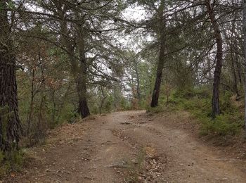
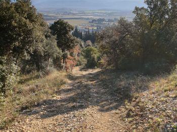
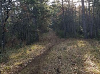
• Sortie de Manosque par la D5, à gauche suivre le chemin de St Martin les eaux. Boucle en forêt de 5 Kms avec de belle...

Trail Walking Manosque - Le tour de la borie '' pain de sucre ''  - Photo
Walking 5.084
Km

Walking

Easy
(1)
Manosque, Provence-Alpes-Côte d'Azur, Alpes-de-Haute-Provence, France
5.1 km | 7.4 km-effort
1h 43min
174 m
173 m
Yes
PITOUSSAINT

• Facile

Trail Walking Manosque - Quartier des Espels, départ Piscine. - Photo
Walking 4.775
Km

Walking

Easy
(1)
Manosque, Provence-Alpes-Côte d'Azur, Alpes-de-Haute-Provence, France
4.8 km | 7.3 km-effort
1h 50min
188 m
187 m
Yes
liocol

Trail Walking Manosque - MANOSQUE VOLX PAR LES COLLINES O S - Photo
Walking 17.714
Km

Walking

Difficult
Manosque, Provence-Alpes-Côte d'Azur, Alpes-de-Haute-Provence, France
17.7 km | 24 km-effort
4h 15min
439 m
433 m
Yes
RobinMicheline

Trail Walking Manosque - 1Les speels, le relais, le pain de sucre. Depart Crématoriome. - Photo
Walking 6.122
Km

Walking

Medium
(1)
Manosque, Provence-Alpes-Côte d'Azur, Alpes-de-Haute-Provence, France
6.1 km | 9.7 km-effort
2h 4min
264 m
268 m
Yes
liocol

Trail Walking Manosque - 1Gaude, boucle de Montaigu.  - Photo
Walking 6.602
Km

Walking

Medium
Manosque, Provence-Alpes-Côte d'Azur, Alpes-de-Haute-Provence, France
6.6 km | 10.2 km-effort
2h 7min
268 m
265 m
Yes
liocol

Trail Walking Manosque - 1Pélicier, chemin des collines, le Chateau via l'Ausselet - Photo
Walking 7.101
Km

Walking

Easy
Manosque, Provence-Alpes-Côte d'Azur, Alpes-de-Haute-Provence, France
7.1 km | 9.7 km-effort
2h 9min
193 m
192 m
Yes
liocol

Trail Walking Manosque - 1La maison bleue, source de Bourne et dalle aux empreintes - Photo
Walking 7.412
Km

Walking

Medium
Manosque, Provence-Alpes-Côte d'Azur, Alpes-de-Haute-Provence, France
7.4 km | 11.2 km-effort
2h 30min
281 m
279 m
Yes
liocol

Trail Walking Manosque - 1En direction de Dauphin, Parking virage Bellevue - Photo
Walking 8.28
Km

Walking

Medium
(1)
Manosque, Provence-Alpes-Côte d'Azur, Alpes-de-Haute-Provence, France
8.3 km | 12.3 km-effort
2h 35min
302 m
304 m
Yes
liocol

Trail Walking Manosque - Gaude, via Bellevue et montaigu - Photo
Walking 8.6
Km

Walking

Medium
Manosque, Provence-Alpes-Côte d'Azur, Alpes-de-Haute-Provence, France
8.6 km | 12.3 km-effort
2h 34min
277 m
274 m
Yes
liocol

Trail Walking Manosque - 1Le tour de la forêt de Pelicier - Photo
Walking 6.675
Km

Walking

Easy
Manosque, Provence-Alpes-Côte d'Azur, Alpes-de-Haute-Provence, France
6.7 km | 9.2 km-effort
1h 49min
188 m
189 m
Yes
liocol

Trail Walking Manosque - 1Le grand Tour de Toutes Aures - Photo
Walking 8.768
Km

Walking

Easy
Manosque, Provence-Alpes-Côte d'Azur, Alpes-de-Haute-Provence, France
8.8 km | 11.1 km-effort
2h 22min
174 m
173 m
No
liocol

Trail Walking Manosque - La Tour du Mont d'Or  - Photo
Walking 5.866
Km
GUIDE

Walking

Very easy
Manosque, Provence-Alpes-Côte d'Azur, Alpes-de-Haute-Provence, France
5.9 km | 8.6 km-effort
1h 43min
206 m
207 m
Yes
lhomme.ph

Trail Walking Manosque - Vestiges de la tour du Mont d'Or. - Photo
Walking 6.733
Km

Walking

Easy
Manosque, Provence-Alpes-Côte d'Azur, Alpes-de-Haute-Provence, France
6.7 km | 9.4 km-effort
2h 2min
197 m
198 m
Yes
liocol

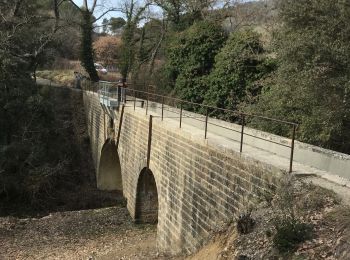
• Garez vous sur le parking, le long de la contre allée, pas de payement, ni zone bleue. Une boucle de 2 H pour monter ...

Trail Walking Manosque - Colline de Pimayon, Gaude. - Photo
Walking 6.722
Km

Walking

Medium
Manosque, Provence-Alpes-Côte d'Azur, Alpes-de-Haute-Provence, France
6.7 km | 10.6 km-effort
2h 14min
290 m
296 m
Yes
liocol

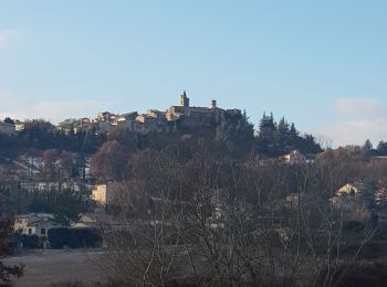
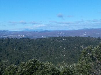
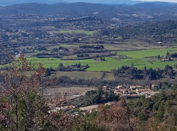
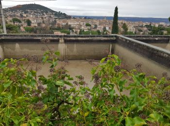
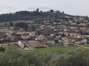
• Garez-vous sur le nouveau Parking de Gaude. Boucle autour de la colline avec de belles vues, comme le Ventoux.

Trail Nordic walking Manosque - Les bassins via st Michel l'aiguille - Photo
Nordic walking 8.222
Km

Nordic walking

Medium
Manosque, Provence-Alpes-Côte d'Azur, Alpes-de-Haute-Provence, France
8.2 km | 12 km-effort
2h 8min
287 m
285 m
Yes
liocol

Trail Walking Manosque - Stationnement Pelicier, direction Dauphin - Photo
Walking 7.709
Km

Walking

Medium
Manosque, Provence-Alpes-Côte d'Azur, Alpes-de-Haute-Provence, France
7.7 km | 11.4 km-effort
2h 24min
278 m
278 m
Yes
liocol

Trail Walking Manosque - Les bassins, jusque la Thomassine - Photo
Walking 7.392
Km

Walking

Easy
Manosque, Provence-Alpes-Côte d'Azur, Alpes-de-Haute-Provence, France
7.4 km | 9.9 km-effort
2h 5min
191 m
188 m
Yes
liocol

Trail Walking Manosque - les bassins deJ.P - Photo
Walking 8.228
Km

Walking

Medium
Manosque, Provence-Alpes-Côte d'Azur, Alpes-de-Haute-Provence, France
8.2 km | 11 km-effort
2h 16min
211 m
206 m
Yes
liocol

Trail Walking Manosque - Le 8 Peugeot Volx - Photo
Walking 6.889
Km

Walking

Medium
Manosque, Provence-Alpes-Côte d'Azur, Alpes-de-Haute-Provence, France
6.9 km | 9.3 km-effort
2h 0min
182 m
182 m
Yes
Duc Vi Khai

20 trails displayed on 135

FREE GPS app for hiking

Logo SityTrail SityTrail

IGN / Geographical institutes

Download SityTrail from the App Store Download SityTrail from Google Play

Logo SityTrail SityTrail World

The world is yours!

Download SityTrail from the App Store Download SityTrail from Google Play Download SityTrail on Huawei AppGallery

Activities

Close
My subscriptions