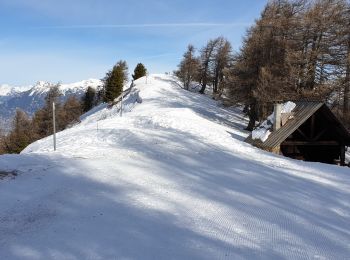
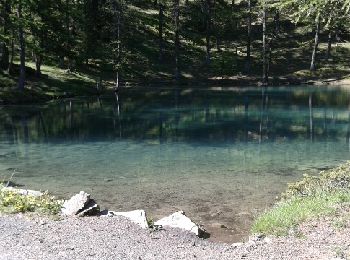
Risoul, Hautes-Alpes, On foot: Best trails, routes and walks

3 comments

Risoul: Discover the best trails: 63 walking and 4 running. All these trails, routes and outdoor activities are available in our SityTrail applications for smartphones and tablets.


The best trails (67)
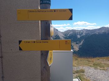
Trail Walking Risoul - Boucle Belvédère de l'homme de Pierre 30.7.22 - Photo
Walking 10.386
Km
GUIDE

Walking

Medium
Risoul, Provence-Alpes-Côte d'Azur, Hautes-Alpes, France
10.4 km | 17.6 km-effort
3h 0min
540 m
543 m
Yes
fredetpascale

Trail Walking Risoul - plan de phazy par la forêt de risoul en boucle - Photo
Walking 17.467
Km

Walking

Difficult
Risoul, Provence-Alpes-Côte d'Azur, Hautes-Alpes, France
17.5 km | 34 km-effort
4h 38min
1234 m
1240 m
Yes
tchoua

Trail Walking Risoul - Crêtes de Penon - Photo
Walking 10.641
Km

Walking

Very easy
(1)
Risoul, Provence-Alpes-Côte d'Azur, Hautes-Alpes, France
10.6 km | 15.3 km-effort
3h 15min
343 m
379 m
Yes
gildascb

Trail Walking Risoul - Risoul 1850  Le Villaret - Photo
Walking 12.342
Km

Walking

Medium
Risoul, Provence-Alpes-Côte d'Azur, Hautes-Alpes, France
12.3 km | 18.1 km-effort
4h 0min
224 m
1066 m
No
Sorriaux

Trail Walking Risoul - Le Villaret  plan Phazy - Photo
Walking 10.929
Km

Walking

Medium
Risoul, Provence-Alpes-Côte d'Azur, Hautes-Alpes, France
10.9 km | 16.5 km-effort
3h 11min
417 m
419 m
Yes
Sorriaux

Trail Walking Risoul - Risoul  le Villaret  Gaudissard - Photo
Walking 4.519
Km

Walking

Very easy
Risoul, Provence-Alpes-Côte d'Azur, Hautes-Alpes, France
4.5 km | 7.6 km-effort
1h 25min
229 m
228 m
Yes
Sorriaux

Trail Walking Risoul - Risoul- Homme de pierre  - Photo
Walking 8.024
Km

Walking

Medium
Risoul, Provence-Alpes-Côte d'Azur, Hautes-Alpes, France
8 km | 14.8 km-effort
3h 21min
506 m
517 m
Yes
cn2912

• famille, vue, myrtille

Trail Walking Risoul - Risoul  les Languieu  - Photo
Walking 4.256
Km

Walking

Very easy
Risoul, Provence-Alpes-Côte d'Azur, Hautes-Alpes, France
4.3 km | 6 km-effort
1h 16min
118 m
173 m
No
Sorriaux

Trail Walking Risoul - risoul 1850/ haut Gaudissard - Photo
Walking 6.369
Km

Walking

Very easy
Risoul, Provence-Alpes-Côte d'Azur, Hautes-Alpes, France
6.4 km | 8.4 km-effort
2h 43min
4 m
596 m
No
egolibre

Trail Walking Risoul - risoul-martinat - Photo
Walking 9.056
Km

Walking

Very easy
Risoul, Provence-Alpes-Côte d'Azur, Hautes-Alpes, France
9.1 km | 13 km-effort
2h 46min
306 m
261 m
No
egolibre

Trail Walking Risoul - la statue de l'homme de Pierre  - Photo
Walking 11.238
Km

Walking

Medium
Risoul, Provence-Alpes-Côte d'Azur, Hautes-Alpes, France
11.2 km | 19.1 km-effort
4h 15min
588 m
587 m
Yes
margotte

• départ de la station de Risoul (Alpes du sud) Belle flore (début juin) la montée sur l'arrête est bien, la statue est...
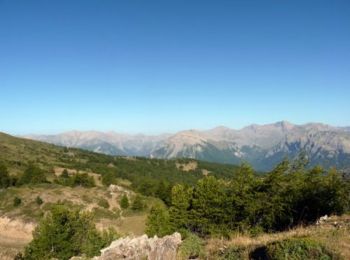
Trail Walking Risoul - Belvédère de l'Homme de Pierre - Risoul - Photo
Walking 10.258
Km

Walking

Difficult
(1)
Risoul, Provence-Alpes-Côte d'Azur, Hautes-Alpes, France
10.3 km | 17.6 km-effort
2h 30min
551 m
556 m
Yes
tracegps

Trail Walking Risoul - L'Homme de Pierre - Photo
Walking 8.864
Km

Walking

Very easy
Risoul, Provence-Alpes-Côte d'Azur, Hautes-Alpes, France
8.9 km | 15.5 km-effort
2h 54min
500 m
497 m
Yes
loicthev

Trail Walking Risoul - pic du clocher - Photo
Walking 12.584
Km

Walking

Difficult
Risoul, Provence-Alpes-Côte d'Azur, Hautes-Alpes, France
12.6 km | 23 km-effort
4h 27min
814 m
814 m
Yes
Dessalien

Trail Walking Risoul - cabane razit par risoul - Photo
Walking 7.369
Km

Walking

Difficult
Risoul, Provence-Alpes-Côte d'Azur, Hautes-Alpes, France
7.4 km | 11.2 km-effort
5h 4min
286 m
284 m
Yes
JosephRigolet

Trail Walking Risoul - Risoul - Photo
Walking 7.801
Km

Walking

Medium
Risoul, Provence-Alpes-Côte d'Azur, Hautes-Alpes, France
7.8 km | 10.8 km-effort
2h 18min
213 m
255 m
No
denisebenoist

Trail Walking Risoul - Risoul : cabane Césier - court - Photo
Walking 5.937
Km

Walking

Risoul, Provence-Alpes-Côte d'Azur, Hautes-Alpes, France
5.9 km | 9.2 km-effort
2h 0min
246 m
244 m
Yes
HSB-GLC

Trail Walking Risoul - Risoul - Le Césier - Photo
Walking 7.715
Km

Walking

Difficult
Risoul, Provence-Alpes-Côte d'Azur, Hautes-Alpes, France
7.7 km | 12 km-effort
2h 43min
323 m
318 m
Yes
HSB-GLC

Trail Walking Risoul - Risoul - boucle chemin à découvrir  - Photo
Walking 3.695
Km

Walking

Medium
Risoul, Provence-Alpes-Côte d'Azur, Hautes-Alpes, France
3.7 km | 6.3 km-effort
1h 36min
197 m
195 m
Yes
HSB-GLC

Trail Walking Risoul - Boucle Appart. Pélinche Césier TK Mélezet - Photo
Walking 8.241
Km

Walking

Risoul, Provence-Alpes-Côte d'Azur, Hautes-Alpes, France
8.2 km | 13.1 km-effort
2h 54min
367 m
364 m
Yes
HSB-GLC

20 trails displayed on 67

FREE GPS app for hiking

Logo SityTrail SityTrail

IGN / Geographical institutes

Download SityTrail from the App Store Download SityTrail from Google Play

Logo SityTrail SityTrail World

The world is yours!

Download SityTrail from the App Store Download SityTrail from Google Play Download SityTrail on Huawei AppGallery

Activities

Close
My subscriptions