![](/images/other/stat-length.png)
SityTrail - 2506836 - beauvoir_20200724_092923
pascalou73
Benutzer GUIDE
![Länge](/images/other/stat-length.png)
Länge
29 km
![Maximale Höhe](https://static1.geolcdn.com/siteimages/upload/files/1508320355ic_sort_altitude_max_24dp.png)
Maximale Höhe
80 m
![Positive Höhendifferenz](https://static1.geolcdn.com/siteimages/upload/files/1508320355ic_sort_den_pos_24dp.png)
Positive Höhendifferenz
203 m
![Km-Effort](/images/other/stat-length.png)
Km-Effort
32 km
![Min. Höhe](https://static1.geolcdn.com/siteimages/upload/files/1508320355ic_sort_altitude_min_24dp.png)
Min. Höhe
1 m
![Negative Höhendifferenz](https://static1.geolcdn.com/siteimages/upload/files/1508320355ic_sort_den_neg_24dp.png)
Negative Höhendifferenz
203 m
![Boucle](https://static1.geolcdn.com/siteimages/upload/files/16400158638029165_repeat_loop_refresh_sync_direction_icon.png)
Boucle
Ja
Erstellungsdatum :
2020-08-08 14:05:16.478
Letzte Änderung :
2020-08-08 14:08:06.163
![Mountainbike](https://static1.geolcdn.com/sitytour/trail-icons/202.png)
--
Schwierigkeit : Medium
![Scannen Sie diesen QR-Code, um die Tour in der SityTrail-Anwendung zu öffnen](https://capi.geolives.com/qq0zvz2zws4bq2lad0pu/sitytour/trails/2506893/qr.png?size=200)
Kostenlosegpshiking-Anwendung
Über SityTrail
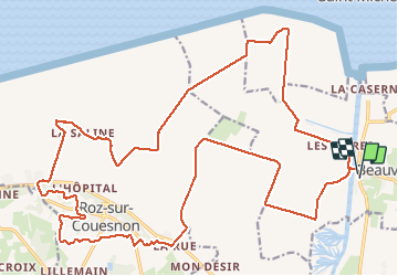
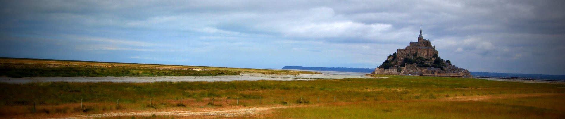
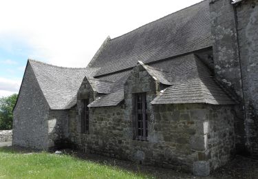
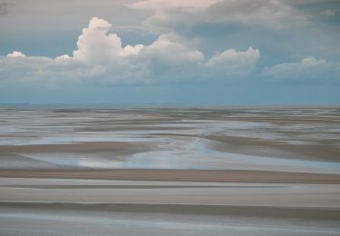
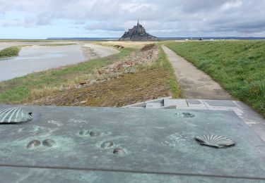
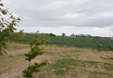
Tour Mountainbike von 29 km verfügbar auf Normandie, Manche, Beauvoir. Diese Tour wird von pascalou73 vorgeschlagen.
Beschreibung
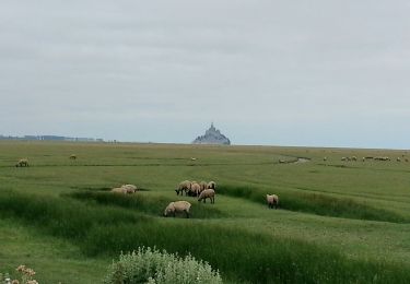
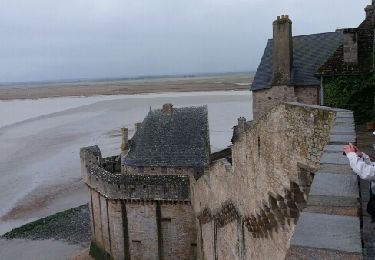
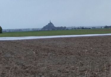
Voilà un VTT sur la région du mont saint Michel le départ se fait au village de Beauvoir .La randonnée entre les belles campagnes de la région et des passages sur des senties de la forêt et le retour par des petites routes entre les champs.
Ort
Land:
France
Region :
Normandie
Abteilung/Provinz :
Manche
Kommune :
Beauvoir
Standort:
Unknown
Gehen Sie:(Dec)
Gehen Sie:(UTM)
609673 ; 5383650 (30U) N.
Kommentare
Touren in der Umgebung
![Tour Zu Fuß Saint-Georges-de-Gréhaigne - Circuit du Petit Bois & de la Grève - Photo](https://media.geolcdn.com/t/375/260/ext.jpg?maxdim=2&url=https%3A%2F%2Fmedia.geolcdn.com%2Ff%2F5902253f-7208-4ff1-b384-45fcc25c7a03.jpeg)
![Zu Fuß Zu Fuß](https://static1.geolcdn.com/sitytour/trail-icons/100.png)
Circuit du Petit Bois & de la Grève
Zu Fuß
Einfach
Saint-Georges-de-Gréhaigne,
Bretagne,
Ille-et-Vilaine,
France
![](/images/other/stat-length.png)
9,1 km | 10,4 km-effort
2h 21min
![](https://static1.geolcdn.com/siteimages/upload/files/16400158638029165_repeat_loop_refresh_sync_direction_icon.png)
Ja
![Tour Zu Fuß Saint-Georges-de-Gréhaigne - Découverte des polders - Photo](https://media.geolcdn.com/t/375/260/ext.jpg?maxdim=2&url=https%3A%2F%2Fmedia.geolcdn.com%2Ff%2F1947c4ab-7a2f-4caa-9962-ed302558c2aa.jpeg)
![Zu Fuß Zu Fuß](https://static1.geolcdn.com/sitytour/trail-icons/100.png)
Découverte des polders
Zu Fuß
Einfach
Saint-Georges-de-Gréhaigne,
Bretagne,
Ille-et-Vilaine,
France
![](/images/other/stat-length.png)
14,6 km | 15,3 km-effort
3h 27min
![](https://static1.geolcdn.com/siteimages/upload/files/16400158638029165_repeat_loop_refresh_sync_direction_icon.png)
Ja
![Tour Wandern Le Mont-Saint-Michel - GR_34_AA_01_Mt-St-Michel_St-Marcan_20230318 - Photo](https://media.geolcdn.com/t/375/260/ext.jpg?maxdim=2&url=https%3A%2F%2Fmedia.geolcdn.com%2Ff%2Fa17250a1-0bf7-444e-8b49-3029941c7cbf.jpg)
![Wandern Wandern](https://static1.geolcdn.com/sitytour/trail-icons/101.png)
GR_34_AA_01_Mt-St-Michel_St-Marcan_20230318
Wandern
Sehr leicht
Le Mont-Saint-Michel,
Normandie,
Manche,
France
![](/images/other/stat-length.png)
16,7 km | 18,7 km-effort
4h 1min
![](https://static1.geolcdn.com/siteimages/upload/files/16400158638029165_repeat_loop_refresh_sync_direction_icon.png)
Nein
![Tour Wandern Le Mont-Saint-Michel - Mont St Michel J2 - Photo](https://media.geolcdn.com/t/375/260/ext.jpg?maxdim=2&url=https%3A%2F%2Fmedia.geolcdn.com%2Ff%2Fb4e16eca-62f6-4a45-b3f4-364badeabd8c.jpg)
![Wandern Wandern](https://static1.geolcdn.com/sitytour/trail-icons/101.png)
Mont St Michel J2
Wandern
Sehr leicht
Le Mont-Saint-Michel,
Normandie,
Manche,
France
![](/images/other/stat-length.png)
17,4 km | 21 km-effort
4h 22min
![](https://static1.geolcdn.com/siteimages/upload/files/16400158638029165_repeat_loop_refresh_sync_direction_icon.png)
Ja
![Tour Wandern Le Mont-Saint-Michel - Mont St Michel J1 - Photo](https://media.geolcdn.com/t/375/260/ext.jpg?maxdim=2&url=https%3A%2F%2Fmedia.geolcdn.com%2Ff%2F2b75de4d-6596-478a-9a3f-dcd60f498a33.jpg)
![Wandern Wandern](https://static1.geolcdn.com/sitytour/trail-icons/101.png)
Mont St Michel J1
Wandern
Schwierig
Le Mont-Saint-Michel,
Normandie,
Manche,
France
![](/images/other/stat-length.png)
12,1 km | 14 km-effort
2h 46min
![](https://static1.geolcdn.com/siteimages/upload/files/16400158638029165_repeat_loop_refresh_sync_direction_icon.png)
Ja
![Tour Wandern Beauvoir - GR_37_AA_15_Beauvoir_Pleine-Fougeres_20210521 - Photo](https://media.geolcdn.com/t/375/260/ext.jpg?maxdim=2&url=https%3A%2F%2Fmedia.geolcdn.com%2Ff%2F45a2928d-2310-48d8-b8a4-fe1aa26383e2.jpg)
![Wandern Wandern](https://static1.geolcdn.com/sitytour/trail-icons/101.png)
GR_37_AA_15_Beauvoir_Pleine-Fougeres_20210521
Wandern
Sehr leicht
Beauvoir,
Normandie,
Manche,
France
![](/images/other/stat-length.png)
14,2 km | 15,5 km-effort
3h 8min
![](https://static1.geolcdn.com/siteimages/upload/files/16400158638029165_repeat_loop_refresh_sync_direction_icon.png)
Nein
![Tour Wandern Huisnes-sur-Mer - Mont-St-Michel - 14km 64m 4h30 - 2017 06 26 - Photo](https://media.geolcdn.com/t/375/260/ext.jpg?maxdim=2&url=https%3A%2F%2Fmedia.geolcdn.com%2Ff%2F9d39b175-437c-4c0f-9152-c4bc208b1660.jpg)
![Wandern Wandern](https://static1.geolcdn.com/sitytour/trail-icons/101.png)
Mont-St-Michel - 14km 64m 4h30 - 2017 06 26
Wandern
Einfach
Huisnes-sur-Mer,
Normandie,
Manche,
France
![](/images/other/stat-length.png)
14 km | 15 km-effort
4h 30min
![](https://static1.geolcdn.com/siteimages/upload/files/16400158638029165_repeat_loop_refresh_sync_direction_icon.png)
Ja
![Tour Wandern Pontorson - sentier roman pontorson - Mont Saint Michel - Photo](https://media.geolcdn.com/t/375/260/ext.jpg?maxdim=2&url=https%3A%2F%2Fservices.sitytrail.com%2FGeolivesWS%2FDownloadMedia.ashx%3FTrailID%3D709832%26Media%3Dfix__20170305102910.jpg)
![Wandern Wandern](https://static1.geolcdn.com/sitytour/trail-icons/101.png)
sentier roman pontorson - Mont Saint Michel
Wandern
Einfach
Pontorson,
Normandie,
Manche,
France
![](/images/other/stat-length.png)
11,4 km | 12,4 km-effort
2h 44min
![](https://static1.geolcdn.com/siteimages/upload/files/16400158638029165_repeat_loop_refresh_sync_direction_icon.png)
Nein
![Tour Wandern Pontorson - pontorson - Mont Saint Michel - Photo](https://media.geolcdn.com/t/375/260/ext.jpg?maxdim=2&url=https%3A%2F%2Fservices.sitytrail.com%2FGeolivesWS%2FDownloadMedia.ashx%3FTrailID%3D709191%26Media%3Dfix__20170305090412.jpg)
![Wandern Wandern](https://static1.geolcdn.com/sitytour/trail-icons/101.png)
pontorson - Mont Saint Michel
Wandern
Einfach
Pontorson,
Normandie,
Manche,
France
![](/images/other/stat-length.png)
11,4 km | 12,4 km-effort
2h 24min
![](https://static1.geolcdn.com/siteimages/upload/files/16400158638029165_repeat_loop_refresh_sync_direction_icon.png)
Nein