


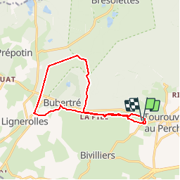

7,8 km | 9,2 km-effort


Benutzer


Kostenlosegpshiking-Anwendung
 SityTrail
IGN / Geografische Institute
SityTrail World
Die Welt öffnet sich für Sie
Tour Wandern von 12,3 km verfügbar auf Normandie, Orne, Tourouvre au Perche. Diese Tour wird von neitag61 vorgeschlagen.
Wandern
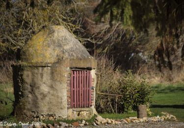
![Tour Wandern Tourouvre au Perche - [Itinéraire] Parcours de découverte de la Réserve de Bresolettes - Photo](https://media.geolcdn.com/t/375/260/ext.jpg?maxdim=2&url=https%3A%2F%2Fmedia.geolcdn.com%2Ff%2F8e304002-6848-4d50-9971-301dd63ddb71.jpg)
Wandern

Wandern
![Tour Mountainbike Tourouvre au Perche - [Itinéraire] Les ruines du château de Gannes - Photo](https://media.geolcdn.com/t/375/260/ext.jpg?maxdim=2&url=https%3A%2F%2Fstatic1.geolcdn.com%2Fsiteimages%2Fupload%2Ffiles%2F1524743154velo.jpg)
Mountainbike

Auto
Mountainbike

Wandern
Wandern
Wandern
Merci Neitag61. Randonnée facile et très agréable, ombragée sur sa plus grande partie. En période humide, il faut sans doute prévoir des bottes pour certains tronçons.